Home > Lighthouse
Lighthouse Article Index
Below is a list of the articles and their authors for each journal published. If searching for a specific article or author you can use your browser's find feature to locate the issue. Each issue has a High and Low link to the high (~125MB) and low (~10MB) resolution versions of the pdf file. Please be patient if you are loading the high resolution version as it could take several minutes for large files. The journal cover image is also a link to the Low resolution version. The table of contents in the pdf file can be used to jump to the specific article. If your browser doesn't support the Table of Contents feature, you can use the page number from the article from the table below to jump to that page.
Lighthouse Edition 82 (2014) - High Low
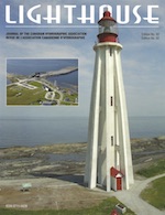 |
3 |
Message from the National President / Message du Président National |
Lighthouse |
4 |
From the Editor's Desk |
Lighthouse |
4 |
The Canadian Hydrographic Association Award - Letter from 2013 Recipient |
Natasha Hahirnick |
5 |
Association of Canada Lands Surveyors News / Nouvelles de L'Association des Arpenteurs des Terres du Canada |
J-C Tétreault |
6 |
Canadian Institute of Geomatics News |
CIG |
10 |
Charting a dynamic seafloor: how an excellent survey becomes a poor data set, and what to tell the mariner |
Leendert Dorst |
16 |
Nautical Geodesy Methods (The Datum Shift Application & The NTX Shifter) |
Sébastien Durand |
30 |
News from The Hydrographic Society of America |
Pat Sanders |
Lighthouse Edition 81 (2013) - High Low
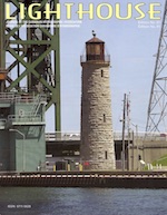 |
5 |
Seafloor Classification: The Use of Hydrographic Data for Seabed Analysis |
S. Finnis |
8 |
Canadian lnstitute of Geomatics News |
CIG |
9 |
Association of Canada Lands Surveyors News |
J-C Tétreault |
9 |
Nouvelles de L'Association des Arpenteurs des Terres du Canada |
J-C Tétreault |
10 |
170 Delegates Attend FEMME 2013 |
Kongsberg |
15 |
Russian Leader Awards Medal to Saanich Man for Wartime Valour |
R. Watts |
17 |
17 Hydrographic Efficiencies of Operating a 19m Research Platform in the Eastern Canadian Arctic |
S. Brucker, J. Muggah, I. Church, J. Hughes Clarke, T. Hamilton, A. Hiroji, W. Renoud |
27 |
Coastal Zone Mapping and lmaging LIDAR (CZMIL) Validation |
D. Dodd, K. Barbor |
38 |
BCIT Students Map English Bay |
D. Rutherford |
Lighthouse Edition 80 (2012) - High Low
 |
5 |
Bedford lnstitute of Oceanography 50 Year Anniversary Celebrations |
CHA Atlantic |
7 |
Call for Nominations - National President - Canadian Hydrographic Association |
CHA National |
11 |
Canadian Hydrographie Association Membership Forms |
CHA National |
13 |
Canadian lnstitute of Geomaties News |
CIG |
20 |
From the Editor's Desk |
Lighthouse |
21 |
International Hydrographie Community News |
Lighthouse / Hydro International |
23 |
Association of Canada Lands Surveyors News |
J-C Tétreault |
24 |
Nouvelles de L'Association des Arpenteurs des Terres du Canada |
J-C Tétreault |
25 |
The Canadian Hydrographic Association Award - Letter From 2012 Recipient |
E. Root |
26 |
Canadian Hydrographic Conference 2012 |
R. Cameron |
33 |
Need for lntegrated Bathymetric and Topographic Maps in Northern Communities |
K. Fadaie |
35 |
Assessing Capabilities for CHS' Law of the Sea Data Management in a Hydrographic Production Database |
S. Lévesque, K. Fadaie |
Lighthouse Edition 79 (2012) - High Low
 |
5 |
Welcome to CHC 2012 |
CHC 2012 Committee / comité CHC 2012 |
6 |
Letter from THSOA President |
P. Sanders |
7 |
Canadian lnstitute of Geomatics News |
CIG |
9 |
Nouvelles de L'Association Canadienne des Sciences Geomatiques |
ACSG |
11 |
The Hydrographic Academy Distance Learning with Plymouth University |
Plymouth University |
20 |
Association of Canada Lands Surveyors News |
J-C Tétreault |
21 |
Nouvelles de L'Association des Arpenteurs des Terres du Canada |
J-C Tétreault |
22 |
Remote Processing of Ship Based Hydrographic Multibeam Data |
R. Hare, D. R. Peyton and J. Conyon |
34 |
CHC 2012 Agenda |
CHC 2012 Committee / comité CHC 2012 |
36 |
CHC 2012 l'ordre du jour |
CHC 2012 Committee / comité CHC 2012 |
38 |
The Clock is Ticking - The Journey for Canada's Submission to the United Nations Commission on the Limits of the Continential Shelf |
S. Forbes, J. Verhoef and D. Mosher |
49 |
CHC 2012 Technical Program - Programme Technique |
CHC 2012 Committee / comité CHC 2012 |
Lighthouse Edition 78 (2011) - High Low
 |
5 |
CHC2012 - Old Challenges - New Approaches |
CHC2012 Committee |
6 |
THSOA 20Il |
K. Wm. Kieninger |
7 |
Reaching Out - lntroducing Students to the Field of Hydrography |
J. DaSilva Lage |
8 |
News from ACLS |
J. Tétreault |
10 |
Nouvelles de I'AATC |
J. Tétreault |
19 |
Survey of Mulberry B |
C. Howlett |
25 |
The Canadian Hydrographie Association A ward - Letter From 2011 Recipient |
B. Eisan |
Lighthouse Edition 77 (2010) - High Low
 |
6 |
U.S. Hydro 2011 - Tampa - Florida |
THSOA |
7 |
Au revoir de Québec- Au revoir from Québec! |
CHC2010 |
11 |
Resection to Enhance GPS Positioning |
N. Stuifbergen |
16 |
The Canadian Hydrographic Association Award - Letter From 2010 Recipient |
Marc-André Barbeau |
17 |
Feature Matching of Digital Images |
N. Stuifbergen |
17 |
Erratum - A Five-Star Solution For The GPS Fix |
Lighthouse |
19 |
Economic Benefits of Hydrography in the Canadian Arctic - A Case Study |
A. Leyzack |
26 |
Report from the CHA-CIG Hydrographer Certification Committee |
CHA-CIG committee on Hydrographer Certification |
29 |
Survey Pests |
C.D. Brown |
32 |
A Project to Create a Database for the Management of Shipwrecks, Obstructions Hazardous Dumps for the Canadian Hydrographic Service |
S. Grant, R. Palmer and S. Forbes |
41 |
The Expanding Role of Hydrography: Meeting Demands for Marine Spatial Information Through the Utilization of Multibeam Sonar Backscatter Data |
C.J. Brown, H. Varma and K. Fadaie |
48 |
Les états côtiers arctiques s'engagent à assurer la sécurité en mer dans l'arctique - L'hydrographe fédérale du Canada : premier président de la Commission hydrographique régionale pour l'Arctique |
|
49 |
Arctic Coastal States Committed to Safety at Sea in the Arctic - Dominion Hydrographer of Canada - First Chair of the Arctic Regional Hydrographic Commission |
|
Lighthouse Edition 76 (2010) - High Low
 |
5 |
La ville de Québec accueille la Conférence hydrographique du Canada 2010 |
|
7 |
Québec City Welcomes the Canadian Hydrographic Conference 2010 |
|
9 |
A Note on Building Hydrographic Surveying Capacity in Small Island Developing States (SIDS) |
D. Neale |
13 |
A Five-Star Solution For The GPS Fix |
N. Stuifbergen |
21 |
A Hovercraft For Marine Geophysical Work Off Canada's Northernmost Frontier |
J.K. Hall and Y. Kristoffersen |
28 |
A Comment on "Marine Boundaries - Towards a Simple Data Representation" |
D. Gray |
30 |
Important Announcement about Canada-wide DGPS Service |
|
31 |
Application of GPS Heights to Bay of Fundy Multibeam Data |
D. Dodd and J. Griffin |
39 |
UNCLOS Update: Spring 2010 |
J.R. MacDougall |
44 |
CHC 2010 Programme / CHC2010 Program |
|
49 |
CHC 2010 Technical Program / Programme Technique |
|
56 |
CHA - Avis Assemblée Générale Annuelle / CHA - Notice of Annual General Meeting |
|
58 |
AATC fête son 25ème anniversaire à la Conférence nationale des arpenteurs-géomètres |
|
59 |
ACLS Celebrate their 25th Anniversary at the National Surveyor's Conference |
|
Lighthouse Edition 75 (2009) - High Low
 |
5 |
The Marine Cadastre |
M. Sutherland |
7 |
Marine Boundaries - Towards a Simple Data Representation |
N. Stuifbergen |
9 |
Queen Elizabeth 2 Grounding- A Lesson Perhaps |
N. Stuifbergen |
9 |
Loran-C Termination Announcement |
N. Stuifbergen |
11 |
The Canadian Hydrographic Association Award Letter From 2009 Recipient |
T. Hamilton |
13 |
Canadian lnstitute of Geomatics - Terms of Reference of the Hydrography Committee |
|
14 |
CHC2010 - Rassemblement hydrographique international à Québec |
|
15 |
CHC2010 - International Hydrographic Gathering in the City of Québec |
|
17 |
Network of Lighthouses and Lightstations of Newfoundland and Labrador - Dedicated as National Historie Civil Engineering Site |
J. Mills |
Lighthouse Edition 74 (2009) - High Low
 |
5 |
Old Ships, New Ships, Red Ships, Blueprints |
R. Hare |
19 |
The Grounding Of The Queen Elizabeth 2 - The Rest Of The Story |
N. Perugini |
27 |
Conférence hydrographique du Canada 2010 / Canadian Hydrographic Conference 2010 |
R. Dorais |
29 |
United States Hydro 2009 Conference Report |
R. Cameron |
31 |
World Hydrography Day 2009 |
R. Cameron, CHA Atlantic |
33 |
The lce Was All Between (Book review) |
D. Gray |
34 |
Mapping The Arctic Seabed: Still A Work ln Progress |
R. Macnab, M. Jakobsson |
41 |
UNCLOS Update : Spring 2009 |
R. MacDougall |
48 |
CHA National 2009 Annual General Meeting Minutes |
CHA National |
53 |
Canadian Hydrographic Association - "The Corporation" |
CHA National |
Lighthouse Edition 73 (2008) - High Low
 |
5 |
Loran-C To Become eLoran |
T. Queeney |
7 |
The Grounding Of The Queen Elizabeth 2 |
B. M. Lusk |
11 |
Highest Quality Throughout All ENC Product Stages Ensuring Highest Possible Quality From Chart To Exhange Sets |
J.K. Klippen |
15 |
Prosposed New LAT/HAT Tide Tables For The CHS |
S. Grant, D. DeWolfe, G. Macleod, D. Nicholson |
27 |
The Wreckers - A Story of Killing Seas, False Lights and Plundered Shipwrecks (Book Review) |
F. Oliff |
29 |
La Barque Surveyor Au 400e De La Ville De Québec |
N. Doucet |
34 |
CHC 2008 Recap |
Lighthouse Staff |
37 |
Thirty Years Of Turmoil, Stress and Achievement |
T. McCulloch |
42 |
The Canadian Hydrographic Association Award Letter From 2008 Recipient |
J. Workman |
Lighthouse Edition 72 (2008) - High Low
 |
5 |
International Hydrographic Organization Tidal Committee |
C. O'Reilly |
7 |
WGS-84 Horizontal Datum Adjustments For Early CHS Charts |
N. Stuifbergen |
9 |
Re-Thinking Arctic Navigation: the Trans-Polar Route |
R. Macnab |
11 |
CHA 2007 National Annual General Meeting Minutes |
|
19 |
BAYCHIMO - Arctic Ghost Ship (Book review) |
D. Gray |
23 |
Canadian Hydrographic Conference and National Surveyors Conference - Conference Abstracts |
|
45 |
UNCLOS Update - Winter and Spring Field Season ln The Far North |
R. MacDougall |
49 |
Conférence hydrographie du Canada et Conférence nationale des arpenteurs-géomètres - La conférence Soustrait |
|
Lighthouse Edition 71 (2007) - High Low
 |
7 |
A HiFix® Mystery Resolved |
N. Stuifbergen |
11 |
Simple classification de données bathymétriques et acoustiques pour Ia caractérisation et Ia gestion d'habitats d'espèces marines |
T. Schmitt, R. Larocque, J.D. Duth |
19 |
Hydrographic Education (Category A) at the Newly Founded HafenCity University, Hamburg (HCU) |
V. Boder, D. Egge |
26 |
The CCGS Matthew Surveys of Northern Labrador |
M. Lamplugh |
31 |
An Update Regarding the Delineation of Canada's Continental Shelf |
R. MacDougall |
34 |
The Canadian Hydrographic Association Award - 2007 Award Recipient |
B. Lusk, K. Seely |
37 |
The World of Gerard Mercator (Book review) |
M. Ruxton |
Lighthouse Edition 70 (2007) - High Low
 |
7 |
Uncertainty Management in Hydrographic Surveys |
R. Hare |
15 |
Transits by Foreign Vessels in Canada's Northern Waters: More than the Safety of Navigation is at Stake |
R. Macnab |
21 |
Marine Electronic Highway: Concept and Opportunities |
R. Gillespie |
28 |
The New Initiatives Fund-Search and Rescue (NIF-SAR) Project |
S. Forbes, D. Regular and C. Zeller |
Lighthouse Edition 69 (2006) - High Low
 |
5 |
Canadian Hydrographic Conference 2006: A Conspectus |
W. Woodford |
7 |
The Effects of Tidal Barriers in High Energy Environments Out of Sight, Out of Mind |
G. Bugden, K. Butler, T.G. Milligan and D. van Proosdij |
11 |
Developing a Real-Time Water Level (RTWL) System for Atlantic Canada |
P. MacAulay and C. O'Reilly |
19 |
Hydro to Navoceano (Book review) |
C. Zeller |
21 |
Challenges in Delineating Canada's Continental Shelf under the United Nations Convention on the Law of the Sea |
R. MacDougall, L. Simard and J. Verhoef |
29 |
The Explorer Chartbook Series: A Work in Progress |
S. Lewis |
44 |
Letter to the Editor - CHA 2006 Student Award |
M. Beaton |
Lighthouse Edition 68 (2006) - High Low
 |
6 |
CHC 2006 Conference Sponsors |
|
7 |
A Universal Hydrographic Database: In Search of the "Holy Grail" |
A. Dmitriev and E. Eik Mong |
10 |
Improved Definition of Wreck Superstructure Using Multi beam Water Column Imaging |
J. E. Hughes Clarke, S. Brucker and K. Czotter |
13 |
The Good Fortune of a Sextant Surveyor |
M. Eaton |
17 |
Charting Northern Waters (Book review) |
F. Oliff |
18 |
CHC 2006 Conference Crossword |
|
19 |
Usage of Oceanographic Databases in Support of Multibeam Mapping Operations Onboard the CCGS AMUNDSEN |
J. Beaudoin, J. E. Hughes Clarke and J. Bartlett |
Lighthouse Edition 67 (2005) - High Low
 |
6 |
Navigator to Hydrographer (Book review) |
S. MacPhee |
7 |
Cartographic Symbolization: An Evolution from Sea Monters to lnuksuit |
J. Mercuri |
13 |
The International Federation of Hydrographic Societies - The Organisation, Past and Present |
H. Atkinson |
15 |
An Overview of Hydrographic Surveying and Mapping Techniques for Coastal Construction Projects in Hong Kong |
S. Y. W. Lam |
19 |
The Franldin Conspiracy (Book review) |
P. Knight |
21 |
Performance Comparison of DGPS and WADGPS for Marine Users |
R. Yousuf |
28 |
CHC2004, Celebrating Canadian Hydrography |
D. Pugh, L.-A. Cornish |
30 |
Letters to the Editor - CHA 2005 Student Award |
J. Wielki |
30 |
Letters to the Editor - Canadian Institute of Geomatics |
K. Allred |
Lighthouse Edition 66 (2004) - High Low
 |
5 |
Pictou Bar Lighthouse: Destroyed by Fire July 5, 2004 |
R. Desborough |
7 |
Bayfield Cottage, Bic, QC |
R. Jackson |
8 |
The Last Years of BAYFIELD (II) Remembered |
A. Leyzack |
11 |
Prediction of Ice Concentration in the Gulf of St. Lawrence Using Modular Neural Networks |
M. EI-Diasty and A. EI-Rabbany |
21 |
S57-Based Paper Chart Production |
A. Pirozhnikov |
27 |
Implications of the Navigation Surface Approach for Archiving and Charting Shallow Survey Data |
A. Armstrong, R. Brennan and S. Smith |
36 |
Establishing a Seamless Vertical Reference along the Tidal Segment of the Saint John River |
J. Zhao, J. E. Hughes Clarke and S. Brucker |
45 |
Canada's Offshore: Jurisdiction, Rights and Management, 3rd edition (Book review) |
B. Calderbank |
Lighthouse Edition 65 (2004) - High Low
 |
5 |
On the Development of an Integrated Navigational Chart System for Marine Navigation in Ice Covered Waters |
A. EI-Rabbany, B. Agi, M. EI-Diasty, G. Dias and D. Coleman |
11 |
The Canada Lands Surveyor Commission - A Proposed Role in the Certification of Hydrographers and Offshore Surveyors |
A. Leyzack |
21 |
CSS ACADIA- the Grand Old Ship of the Canadian Hydrographic Service |
E. Brown |
30 |
CCGS AMUNDSEN: A New Mapping Platform for Canada's North |
J. Bartlett, J. Beaudoin and J. Hughes Clarke |
40 |
GEBCO's Second Century - Looking ahead for the General Bathymetric Chart of the Oceans |
D. Monahan |
43 |
An Exciting End to a Survey Season |
A. Miller |
44 |
50 Years ago … The Dream of the St. Lawrence Seaway |
J. H. Marsh |
45 |
MANDALAY to NORSEMAN (Book review) |
D. St. Jacques |
Lighthouse Edition 64 (2003) - High Low
 |
5 |
Fifty Years Later ... Winnipegosis 1953 - The Story of the Setting Up of a New Survey and the Introduction to Survey Work of a Would Be Hydrographer |
Sidney van Dyck |
11 |
S-44 and Multibeam Echosounding |
Stephen B. MacPhee and Rob Hare |
19 |
Rosie of the Chatham Bar, Monaco |
Steve Ritchie |
22 |
Hydrographic Lidar Processing Moves into the Next Dimension |
Karen Francis, Paul LaRocque, Lindsay Gee, and Mark Paton |
34 |
Let There Be Light |
Graham A. Scholes |
38 |
As it Was (Book review) |
Sam Weller |
39 |
The History of GEBCO 1903-2003 (Book review) |
Stephen B. MacPhee |
Lighthouse Edition 63 (2003) - High Low
 |
7 |
Seamless Digital Data and Vertical Datum |
R. Adams |
13 |
Navigation Representative's Roles, Responsibilities and Benefits |
B. Calderbank |
22 |
Canada's Role in Advancing lnteroperability Through the Open GIS Consortium (OGC) |
M. Reichardt |
26 |
Finding one-of-a-kind British Admiralty Charts at CHS |
D.H. Gray |
28 |
Creation by Katherine Govier - Book review |
A. Brown |
29 |
The Electronic Chart; Functions, Potential and Limitations of a New Marine Navigation System - Book review |
Captain J.D. Pace |
31 |
AIS & ECDIS - From a Mariner's Perspective |
Captain S.W Poole |
Lighthouse Edition 62 (2002) - High Low
 |
5 |
The WEXFORD - Elusive Shipwreck of the 1913 Great Storm |
P. Carroll, Photos- M. Wachter and G. Wachter |
9 |
Minimising Offshore Survey Product Liability |
B. Calderbank |
13 |
A Decade of SURVEYOR |
A. Leyzack, B. Power and H. Duller |
21 |
A Comparison of Shallow Water Multi beam Systems from a Commercial Viewpoint |
D. Mallace |
31 |
CHC2002 Summary |
|
32 |
CHC2002 Toast and Topics |
|
Lighthouse Edition 61 (2002) - High Low
 |
4 |
Improving a Multi-Reference GPS Station Network Method for OTF Positioning in the St. Lawrence Seaway |
L.P. Fortes, M.E. Cannon, S. Skene, G. Lachapelle |
12 |
Completion of the CHA/CIDA Malaysia Hydrographic Training Project 1985-200 I |
TD.W McCulloch |
17 |
Augmentation of DGNSS With Dynamic Constraints For Marine Navigation |
S. Ryan, G. Lachapelle |
25 |
Canadian Hydrographic Conference 2002 Program / Programme de Ia Conference hydrographique du Canada 2002 |
|
70 |
Friends of Hydrography |
S. van Dyck |
71 |
Charts for the Blind and Visually Impaired? |
G. Macdonald |
Lighthouse Edition 60 (2001) - High Low
 |
7 |
First Steps on the Quality journey |
S. Hinds, A O'Connor |
15 |
Future Trends In Marine Navigation and Positioning Technology |
G. Lachapelle, S. Ryan |
39 |
IHO S44 Standards for Hydrographic Surveys and The Variety of Requirements for Bathymetric Data |
D. Wells, D. Monahan |
Lighthouse Edition 59 (2001) - High Low
 |
7 |
The Atlantic Canada Lighthouse Inventory Project |
R. Welsford, J. Barkhouse and S. Grant |
12 |
Radio Positioning Accuracies |
B. Calderbank |
17 |
Variable Errors and Fixed Boundaries: The Role of Deep Echosounding in the United Nations Convention on Law of the Sea (UNCLOS) |
D. Monahan |
25 |
A multi-disciplinary, multi-agency, multi-beam survey of Georgia Basin |
R. Hare, E. Sargent, K. Czotter, N. Sutherland, D. Mosher and V. Barrie |
35 |
Discovering Rocks off Labrador: A Photo Essay |
D. H. Gray |
Lighthouse Edition 58 (2000) - High Low
 |
7 |
Survey, Navigation and Positioning Guidelines for 3D Marine Seismic Survey Specifications |
B. Calderbank |
19 |
Comparaison de l'altitude GPS d'un navire avec des données marémétriques |
S. Michaud, R. Santerre et A. Gondal |
27 |
Determination of Mean Sea Level with GPS on Vessel |
R. M. Atkan and H. M. Palancioglu |
33 |
Ten Years of a Canadian In Monaco |
A. J. Kerr |
38 |
Winter Storms on the Great Lakes |
R. Solvason and C. Robinson |
Lighthouse Edition 57 (2000) - High Low
 |
7 |
The Use Of Multiple Receivers For Constraining Gps Carrier Phase Ambiguity Resolution |
E. Cannon and S. Weisenburger |
19 |
Comparaison des mèthodes d'interpolation Kriging et Voronoi dans un contexte bathymètrique |
S. Rivest, A.R. Gondal et C.M. Gold |
29 |
The Canada-Malaysia Hydrographic Connection |
T.D. W. McCulloch |
Lighthouse Edition 56 (1997) - High Low
 |
7 |
Some Anomalies In A Spanish Chart Of Vancouver Island 1791 |
N. A. Doe |
21 |
Establishment of a Hydrographic Bureau in Egypt |
J.-M. Gervais |
29 |
Maintenance and Use of Lead Acid Batteries in Hydrographic Applications |
A. Thompson, B. Hinds and L. Dorosh |
Lighthouse Edition 55 (1997) - High Low
 |
7 |
Thirty Years of Turmoil, Stress and Achievement |
T. McCulloch |
12 |
Harmonic Analysis and Tidal Predictions |
W.R. Crawford |
21 |
Hydrographic Surveying At The University Of Otago, New Zealand |
C. Spencer and N. Sutherland |
Lighthouse Edition 54 (1996) - High Low
 |
6 |
Malaysia Project CHA/CIDA |
B. M. Lusk |
7 |
Use of Low-Cost GPS Receiver Technology for Sonobuoy Positioning |
H. Sun, M. E. Cannon, G. Lachapelle, D. Connell and P. Shouldice |
13 |
Using DGPS To Measure The Heave Motion Of Hydrographic Survey Vessels |
P. Kielland and J. Hagglund |
23 |
Twenty-five Years of Co-Operation |
L. M. Reading |
25 |
Upgrading of Arctic Charts and Conversion to NAD83 : Final Report |
W. Mazoka and R. Bennetto |
Lighthouse Edition 53 (1996) - High Low
 |
7 |
Canadian Active Control System-Delivering The Canadian Spatial Reference System |
R. Duval, P. Heroux and N. Beck |
15 |
Application du GPS et I' approche On-The-Fly en temps réel pour les relevés bathymétriques |
G. Marceau, Dr. B, Morse, G. Bouchard, Dr. R. Santerre, D. Parrot et É. Roy |
21 |
GPS Reality Checks |
D. Wells |
Lighthouse Edition 52 (1995) - High Low
 |
7 |
Developing Hydrographic Applications Using Relational Technology and Multi-Dimension Codes |
The CHS Source Data Base Team |
13 |
Precise GPS Shipborne Positioning Experiments With Code and Semicodeless Receivers |
G. Lachapelle, H. Sun, M. E. Cannon and C. McMillan |
21 |
Positionnement GPS avec des mesures de pseudodistance filtrées et lissées |
R.Santerre, É. Roy et D. Parrot |
31 |
Upgrading Nautical Charts in Canada's Arctic Using Landsat Thematic Mapper ™ |
G. Tomlins, P. Wainwright and M. Woods |
41 |
Une mission au large de Boston (Massachusetts Bay), un exemple de partenariat international |
R. Sanfaçon, a.f. |
Lighthouse Edition 51 (1995) - High Low
 |
7 |
Electronic Charts: The Course to Go |
Captain John Pace |
11 |
Reaping the Fruits of the Labour: Learning to Cope? |
Julian Goodyear |
15 |
Implementing ECDIS Worldwide: Challenges and Opportunities |
Dr. Lee Alexander |
19 |
Meeting the Need for Electronic Chart Data World Wide |
Fosco Bianchetti and Brian Terry |
Lighthouse Edition 50 (1994) - High Low
 |
7 |
Real Time Kinematic GPS and HYDRO Software for Beach Profiles |
M. Perwick, G. Chisholm |
9 |
War Record of Hydrographic and Map Service |
F. C. Goulding Smith |
15 |
Captain Vancouver's Assessment of Kendall's Chronometer K3 1791/1792 |
N. A. Doe |
Lighthouse Edition 49 (1994) - High Low
 |
7 |
Le système d'information SINECO / The COWLIS Information System |
B. Tessier, S. de Margerie, D. Hains, P. Hally |
15 |
Royal Navy Hydrographers Honoured |
R. W. Sandilands |
19 |
A Quantitative Comparison of the Towed In-Flight Bathymetry System with Launch-Borne Acoustic Soundings near Coppermine, NWT |
J. S. Holladay, D. Wright, M. R. Crutchlow, A. Koudys |
25 |
The Acoustic Scintillation Flowmeter: Applications for a New Environmental Tool |
T. Curran, D. Lemon, Z. Ye |
Lighthouse Edition 48 (1993) - High Low
 |
7 |
A Public/Private Sector Alliance for the Production and Distribution of Electronic Charts |
B. F. Terry and N. M. Anderson |
11 |
A Modern Quantification of Historic Hydrographic Data Accuracy |
R. Hare and D. Monahan |
21 |
An Analysis of Captain Cook's Longitude Determinations at Nootka, April 1778 |
N. A. Doe |
31 |
The ASIA Tragedy |
M. J. Casey |
Lighthouse Edition 47 (1993) - High Low
 |
9 |
Real-Time Acoustic Bottom Classification for Hydrography A Field Evaluation of RoxAnn |
G. E. O. Schlagintweit |
15 |
Where Was Nootka in 1792? An Explanation of Captain Vancouver's Longitudinal Error |
N. A. Doe |
19 |
Towards IHOstat: IHO-Approved Software Which Evaluates the Quality of Bathymetric Data |
P. Kielland, K. Burrows, B. Ward, M. Dagbert, R. Velberg |
Lighthouse Edition 46 (1992) - High Low
 |
5 |
Perigean Spring Tide in Loughborough Inlet, July 1792 |
N. A. Doe |
11 |
Oil Spill Simulations in Hecate Strait |
W. Crawford |
15 |
The Role of Topology in Spatial Information Systems |
P. N. Holroyd |
19 |
The ECDIS Paradox |
F. Bianchetti |
25 |
A Farewell to CSS Bayfield |
M. Birchall |
Lighthouse Edition 45 (1992) - High Low
 |
7 |
Cape Sable |
B. J. Smith |
15 |
Land Settlements and Aboriginal Self-Government |
P. D. Knight |
21 |
A Field Evaluation of the KAE Fansweep - A Portable, Shallow-Water, Multi-Beam Sonar System |
P. R. Milner and J. L. Galloway |
29 |
Fansweep Tests - Manufacturer's Comments |
I. Harre and V. Meyer |
31 |
The CHA/CB Heritage Launch Project |
A. Leyzack |
39 |
LORAN-C Signal Analysis in the Lower St. Lawrence Using a Mobile GPS System |
B. Townsend, G. Lachapelle and D. Hains |
Lighthouse Edition 44 (1991) - High Low
 |
7 |
A Landlubber at Sea |
W Covey |
13 |
The Influence of MACDIF on International Digital Geomatic Exchange Standards |
C. D. O'Brien and T. V. Evangelatos |
16 |
First World War Remembered in Lake Superior (near Marathon, Ontario) |
D. H. Gray |
19 |
A Canadian View of the Development of Malaysian Hydrographic Capability over the Last Decade |
T. D. W McCulloch |
25 |
Role of Hydrography in Marine Investigations and Litigation |
R. Ekblom |
29 |
James Cook Monument - Newfoundland |
L. M. Cumming |
Lighthouse Edition 43 (1991) - High Low
 |
7 |
Impulse Radar Bathymetric Profiling In Weed-Infested Fresh Water |
A. Kovacs |
15 |
Surveying with Radio and Acoustics |
A. Miller |
17 |
The KEL 320A Arctic Sounder |
W. D. Fretts and M. R. Crutchlow |
21 |
Canada's Lighthouse Stamps |
R. Robitaille |
27 |
The Electronic Chart In 1991 - The CHS's Changing Development Role |
The CHS Electronic Chart Working Group |
Lighthouse Edition 42 (1990) - High Low
 |
7 |
Machine Scanning as an Alternative to Manual Digitizing |
P. Holroyd |
11 |
Number 8 |
W. Covey |
17 |
The U.S. Navy's Hydrographic Program |
Rear Admiral J. E. Koehr |
21 |
Real-Time Differential GPS: The Ultimate Positioning System for Hydrographic Surveys |
P. Kielland and D. Neufeldt |
25 |
An Estimation of the Human Error in a Manually Scaled Echo Sounding |
G. Thompson |
Lighthouse Edition 41 (1990) - High Low
 |
9 |
The Automatic Selection of Prime Soundings for Nautical Chart Compilation |
S. Zoraster |
15 |
A Digital Depth Model and Automated Contours |
J .S. Warren, L.G. Boone, and P. Guibord |
19 |
A Cartographic Tale a Half-Century Old |
W. Covey |
23 |
Validation |
J.R. MacDougall |
27 |
GPS and the Electronic Chart Will Go a Long Way Towards Preventing Tanker Groundings |
R. M. Eaton |
33 |
Marine DGPS Using Code and Carrier in a Multipath Environment |
G. Lachapelle, W. Falkenberg, D. Neufeldt and P. Kielland |
Lighthouse Edition 40 (1989) - High Low
 |
7 |
An Arctic Mid-Summer's Night Frolic |
J. Green |
13 |
Digital Terrain Models in Marine Cartography |
Dr. lng. H. W. Schenke |
17 |
Geographical Naming Practices of William J. Stewart |
David H. Gray |
25 |
Nautical Chart Production Using Digital Data and lnteractive Compilation |
R. D. Bell, R. E. Chapeskie, W. S. Crowther, K. R. Holman, D. M. Jackson and S. R. Oraas |
31 |
Probability of Detecting Errors in Dense Digital Bathymetric Data Sets by Using 3D Graphics Combined with Statistical Techniques |
H. Varma, H. Boudreau, M. McConnel, M. O'Brien and A. Piccott |
37 |
Acoustic Surveys: Implications to the Geoscience Discipline |
R.L. Thomas, R.K. McMillan, and D.l. Keyes |
Lighthouse Edition 39 (1989) - High Low
 |
1 |
HYDROSTAR: A Computer Program For Accurate GPS Real-Time Kinematic Differential Positioning |
G. Lachapelle, W. Falkenberg, M. Casey and P. Kielland |
7 |
ECDIS Development In Canada |
G. Macdonald, S. Grant, M. Eaton, J. MacDougall, B. Beale and P. Leenhouts |
13 |
ASF Chartlets: A Picture is Worth a Thousand Numbers |
D. H. Gray and R. M. Eaton |
19 |
Managing Change: A Challenge of the Information Age |
J. R. MacDougall |
25 |
Canadian Preparations For The Swath Sounding Era |
P. Kielland and P. Hally |
Lighthouse Edition 38 (1988) - High Low
 |
3 |
The Canadian Hydrographic Association and Hydrographic Training In the Third World |
T. D. W. McCulloch |
5 |
The History and Problems of Collecting, Storing and Manipulating Hydrographic Data |
R. Mehlman |
7 |
The Field-Ing of a Cartographer (or "So That's How It's Done") |
D. Jackson |
9 |
Tests du récepteur LORAN-C lnternav 408 pour des application aéroportées |
P. Bélanger et P. Bellemare |
15 |
An Efficient Storage Structure for Bathymetric Data |
N. Sarda and D. Matthews |
21 |
Self-Tracking Range/Bearing Positioning Systems - An Evaluation |
G. Fenn, P. Millette, B. Tinney and D. St. Jacques |
35 |
The Canada-France Border Dispute |
R. Karczuga |
Lighthouse Edition 37 (1988) - High Low
 |
1 |
Simplified Tidal Analysis and Prediction |
S. T. Grant |
19 |
Creating a Shellfish Toxin Chart Using CHS/CARIS |
P. Holroyd |
23 |
Legal Jurisdiction over the Titanic |
A. Ruffman, I. Townsend Gault and D. VanderZwaag |
40 |
Des Barres and the Atlantic Neptune |
J. B. Ross |
41 |
An Analysis of Chart Sales |
D. Monahan and F. Mior |
47 |
The Hydrographer: Chronic Sufferer of V.E. |
D. Pugh |
51 |
A Hydrographic Information System |
J. R. MacDougall |
63 |
Hydrographic Training in Malaysia |
Hans J. Gray |
Lighthouse Edition 36 (1987) - High Low
 |
3 |
Electrostatic Plotting: POD (Print on Demand) and Related Projects |
D. Vachon |
9 |
A Canadian Technical Cooperation Program |
Rear Admiral D. C. Kapoor |
12 |
PulstracTM |
P.K.Dano |
17 |
Offshore Construction and Inspection |
B. Calderbank |
Lighthouse Edition 35 (1987) - High Low
 |
3 |
High Accuracy Surveying Positioning Control |
Dieter MacKenthun |
7 |
An Application of Acoustic Core Analysis |
Michael R. Tarbotton and Douglas S. Murphy |
12 |
Five Years of Scanning Sonar Experience in the Beaufort |
Hugh R. Stewart |
Lighthouse Edition 34 (1986) - High Low
 |
7 |
A Permanent Gauging System for Arctic Application |
Denis St. Jacques |
11 |
Évaluation de Ia Précision du Polarfix de Krupp-Atlas |
|
18 |
GPS-Current Capabilities and Multi-purpose offshore surveying |
Dr. Gérard Lachapelle |
24 |
Multibeam Echo-Sounder - SIMRAD EM100 |
Freddy Pohner |
30 |
Two Hundred Years Ago (1786) La Perouse Explored the Coasts of North America From Alaska to California |
L'lngénieur général de I'Armement BOURGOIN |
30 |
Il y a deux cents ans (1786), La Perouse explorait les côtes d' amérique du nord entre I' Alaska et Ia Californie |
L'lngénieur général de I'Armement BOURGOIN |
Lighthouse Edition 33 (1986) - High Low
 |
5 |
Horizontal Accuracy of Soundings and the ARGO DM-54 |
M.V. Woods |
10 |
Cartographic Design Considerations for the Electronic Chart |
Stephen J. Glavin, David Monahan |
13 |
A Cartographer's Experience on a Field Survey |
Bernard Kenny |
14 |
Pictorial display - Lighthouses |
David H. Gray |
16 |
Implementation of North American Datum of 1983 into CHS National Charting program |
|
21 |
Vice Admiral William FitzWilliam Owen and his Life in Canada |
Julian E. Goodyear |
Lighthouse Edition 32 (1985) - High Low
 |
3 |
The Voyage of George Vancouver 1791-1795 |
W. Kaye Lamb, Rear Admiral Steve Ritchie |
5 |
Upgrade of the Cartographic Workstations |
Timothy V Evangelatos |
13 |
Verifying The Gulf of Maine Computations |
David H. Gray |
20 |
Some Comments on Canadian Fisherman's Charts 43058 A 85 of Sable Island Bank |
Alan Rullman |
29 |
The Influence of International Standards on the Training and Education of Hydrographers |
Adam J. Kerr |
Lighthouse Edition 31 (1985) - High Low
 |
3 |
An Opinion - Computer Assitance |
Adam J . Kerr |
5 |
Evaluation of The QUBIT TRAC IV B |
H.P. Varma |
13 |
The Use of Sea Level Tide Gauge Observations in Geodesy |
Gala Carrera and Petr Vanicek |
20 |
The Hydrographic Contouring System Practical Experiences |
Dan McDonald and Carl Czotter |
24 |
Next Generation Plotters |
Don H. Vachon |
Lighthouse Edition 30 (1984) - High Low
 |
3 |
The Tsunami Warning System in the Pacific |
G. C. Dahler |
14 |
John P. Tully |
R.W. Sandilands |
18 |
How Often Should Charts Be Reissued |
S. B. MacPhee |
20 |
Interactive Graphics Editor for Hydrography |
Herman Varma |
28 |
The Advantages of Using a Ship as a Dynamic M.R.S. Station |
G. W Henderson, C.L.S. and H. P Varma |
30 |
Contours and Contouring in Hydrography Part II - Interpolation |
M.J. Casey and D. Monahan |
38 |
Dolphin: A Proven Hydrographic Vehicle |
A. K. Malone, R. G. Burke and R. Vine |
Lighthouse Edition 29 (1984) - High Low
 |
6 |
Education Seminar |
Bruce C. Calderbank |
8 |
While Memory Serves - Reminiscences of a Hydrographer Aboard a M.O.T. Icebreaker |
|
21 |
Review - The Future of Hydrography |
Rear Admiral G. S. Ritchie |
22 |
Fisheries Sonar |
R.B. Mitson |
24 |
Satellite Bathymetry - Fact or Fiction? |
David Monahan |
30 |
The Largest Tides in the World |
Lung-fa Ku |
33 |
Canadian Data Report of Hydrography and Ocean Sciences No. April 1984 - Field Testing of the Hewlett-Packard 7914 Winchester Disk Aboard C.S.S. Baffin |
H. P. Varma |
37 |
Utilization of Doppler-Inertial Techniques for the Establishment of Survey Control for Hydrography |
J. F. Mclellan, G. H. Eaton, K. W Schuurman |
41 |
Impact of Global Positioning System on Hydrography |
David Wells, Gerard Lachapelle, Michael Eaton, Stilianos Mertikas |
Lighthouse Edition 28 (1983) - High Low
 |
4 |
Bubble Memory |
Gavin McLintock and George Macdonald |
9 |
Dolphin: On Trail |
K. Malone |
10 |
Contours & Contouring in Hydrography |
D. Monahan and M. J. Casey |
19 |
Airborne GPS Trials |
M. J. Casey, N. Beck, R. J. MacDougall and R. A. O'Neil |
22 |
Annual Report |
A.D. O'Connor |
23 |
Loran-e Calibration of Large Scale Charts |
M.J. Gourley and J. Turpin |
26 |
The Microfix 100C |
P.R. Milner |
35 |
New Bathymetry for the Queen Elizabeth Islands |
John Warren |
36 |
Oh Say can you see? |
John Cookson |
39 |
Recovering Datum Reference |
Richard Palmer |
41 |
Reminiscences of a Retired Hydrographer |
N.S. Gray |
47 |
Gazetteer of Undersea Feature Names 1983 |
DFO |
49 |
Using the Digital Database to See Between the Lines |
Peter Kielland |
55 |
Errata - The CHS (Atlantic) Sweep Program (Edition 27) |
R. Burke |
Lighthouse Edition 27 (1983) - High Low
 |
2 |
Scanning LIDAR Bathymeter |
A. K. Malone, M. J. Casey, and D. Monahan |
13 |
Stories of Canada's Lakes and Rivers - A Humanistic Counterweight to Baffin Island |
Farrell Boyce, George and Eva Macdonald |
22 |
Surveying The Sands Off Sable |
Adam J. Kerr |
25 |
The Canadian Hydrographic Service (Atlantic) Sweep Program |
R. Burke |
31 |
Sunspot activity and tsunamis in the Pacific Ocean |
T. S. Murty |
34 |
Second Institute of Oceanography, China |
Shouren Lin |
35 |
MiniFix Winter Trials in Northumberland Strait |
N. Stuifbergen |
39 |
Steady Bottom Current in Hudson Bay |
F.G. Barber |
45 |
Nautical Chart Development |
Commodore A. H. Cooper, RAN (Retd) |
Lighthouse Edition 26 (1982) - High Low
 |
1 |
The Canadian Hydrographic Service - Courses in Marine Cartography |
H. Furuya |
7 |
An Upwelling Gyre off the West Coast of Vancouver Island |
Kenneth L. Denman. Howard J. Freeland and David L. Mackas |
10 |
Meteorology and Oceanography in the Falkland Islands Region |
T. S. Murty |
14 |
Un Survol Historique De I'Hydrographie Au Canada Français |
Patrick Hally |
19 |
Experiences With A Smart Digitizer |
Paul Millette |
25 |
Book Reviews |
S. B. MacPhee, J. H. Well er, A. J. Kerr and R. M. Eat |
29 |
Leaving Home |
Peter Duffy |
30 |
Comparisons Between Acoustic and Active and Passive Optical Depth Measuring Systems |
David Monahan, M. J. Casey and R. J. MacDougall |
42 |
Reminiscences of the Admiralty Newfoundland Survey |
R. W Sandilands |
Lighthouse Edition 25 (1982) - High Low
 |
3 |
Assignment Egypt |
G. E. Richardson |
5 |
The Canadian Hydrographic Service - Hydrography I and Hydrography II Courses |
H. Furuya |
14 |
Notes on the Bay of Fundy and Gulf of Maine Current Atlas |
D. L. DeWolfe |
17 |
Hydrographic Surveying Under Adverse Conditions |
Lt. Cdr. Alan D. Anderson and Capt. Wayne L. Mobley |
22 |
Water Level Transfers to Determine Geodetic Elevations in Lake Ontario |
Herbert W Stoughton |
26 |
Quick Loran-e to Geographic Conversions |
Langley R. Muir |
31 |
Book Reviews |
S. B. MacPhee and R. M. Eaton |
32 |
The Hydrographic Survey of Fury and Helca Strait |
G. W Henderson |
36 |
The Joint Canadian-United States Beaufort Sea Expedition |
W M. Cameron and F. G. Barber |
39 |
Opinions: Smoothing and Multi-Ranging |
R. M. Eaton |
41 |
Opinions: Multi-Ranging - An Expensive Solution to a Simple Problem |
M. J . Casey |
Lighthouse Edition 24 (1981) - High Low
 |
2 |
Pavlov's Hydrographers |
A.D. O'Connor |
4 |
Canadian Hydrographic Workshop, Quebec, 1982 |
R.S. Sanfaçon |
5 |
Improving the Performance of the Motorola MRS |
M.J. Casey |
10 |
Charting the Beaufort Sea |
R.W. Sandilands |
13 |
The Marine Arctic Route Reconnaissance System |
G. Macdonald and J. Medendorp |
23 |
A Review of Digital Terrain Modelling Applied to Hydrographic Charting Activities |
Dr. Pam Sallaway |
32 |
"Smart" Digitizer Proven in Arctic |
E.A. Meyer |
34 |
Mathematics and Computing Syllabuses for Hydrographers in Canada |
D.E. Wells |
38 |
Book Review |
J. Goodyear |
Lighthouse Edition 23 (1981) - High Low
 |
2 |
Subtense 2 |
J.V. Crowley |
6 |
Integration of NAD 83 into the Charting Program of the United States and Canada |
W.J. Monteith, D.H. Gray |
10 |
The Tidal Streams Surrounding Vancouver Island |
W.R. Crawford, W.S. Huggett |
18 |
Large Scale Surveys with the AGA Geodimeter 120 |
Gary Rockwell |
22 |
From a Hydrographers Sketchbook Impressions of India |
George and Eva Macdonald |
26 |
Range Errors In Microwave Systems |
R.M. Eaton |
Lighthouse Edition 22 (1980) - High Low
 |
2 |
Sounding Selection from a Digital Data Base |
G. D. Macdonald |
6 |
Statistical Analysis of Pingo·Like Features in the Beaufort Sea |
Dr. B. R. Johnson |
23 |
The 1980 HMS Breadalbane Expedition |
M.I. Mogg |
28 |
The Field Sheet as an Inefficient Medium |
M.J. Casey |
30 |
The Canadian Princess |
R.W. Sandilands |
Lighthouse Edition 21 (1980) - High Low
 |
1 |
The Hydrographic Commission of FIG |
T.D.W. McCulloch |
5 |
Tellurometer MRD1 Field Evaluation |
J.R. MacDougall |
9 |
The Case of the Poached Lobsters |
A.J. Kerr |
12 |
The Acadia Goes to the Nova Scotia Maritime Museum |
R.M. Eaton |
14 |
The Man Who Had Been Right |
G. Macdonald |
16 |
Analytical Models for Automated Water Level Reduction of Soundings |
D. B. Thomson, E.G. Okenwa |
Lighthouse Edition 20 (1979) - High Low
 |
1 |
Charlie Golf Foxtrot Quebec |
R.W. Sandilands |
4 |
Computerized Chart Reproduction for Scientific Applications |
R. Gottinger |
8 |
Storm Surge Amplitudes in the St. Lawrence Estuary |
T.S. Murty, M.l. EI-Sabh, J.-M. Briand |
10 |
The Origin of 'The Origin of the Species' |
G. Macdonald |
20 |
Arctic Survey Uses Helicopter Mounted Spike Transducer |
P. Davies |
22 |
Comments on the lnternav Loran-C Co-ordinate Converter Unit (CC-2) |
A.R. Mortimer |
Lighthouse Edition 19 (1979) - High Low
 |
1 |
Whose Name Was Writ in Water |
R.W. Sandilands |
7 |
The Mini-Ranger Data Processor Automated Positioning System - A Useful Tool for Positioning Sweeps |
M.V. Woods |
12 |
Municipal Place Names and Hydrographers |
David Honahan |
Lighthouse Edition 18 (1978) - High Low
 |
3 |
Arctic Hydrography - Past, Present and Future 3 |
S.B. MacPhee, M. Crutchlow, D. Knudsen |
6 |
SYLEDIS - A New Medium - Range Positioning System |
N. Stuifbergen |
9 |
The Impact of Fundy Tidal Power on the Hydrography of the Area |
Barry J . Mooney |
13 |
Sydney's Hydrographer |
R.W. Sandilands |
15 |
Evaluation of Motorola's Mini Ranger Data Processor and Automated Positioning System |
K.T. White, M.A. Hemphill |
20 |
Feds solve 4 year old crime |
R.W. Sandilands |
21 |
The Amoco Cadiz And All That |
A.J. Kerr |
24 |
Dependable Digital Depths |
J .V. Watt |
Lighthouse Edition 17 (1978) - High Low
 |
1 |
Canada's Hydrographic Role in FIG |
T.D.W. McCulloch |
3 |
Landsat Goes To Sea |
James C. Hammack |
10 |
Geometrical Probability and Hydrography |
David Monahan |
14 |
NavBox - A Microprocessor-Based Navigation Aid |
R.L.K. Tripe |
20 |
On-Line Automation of a Hydrological Data Acquisition System |
Th. Bruins |
24 |
Sound Velocity Distribution and its Effect on Sounded Depths for Hudson Bay |
S.J. Prinsenberg |
30 |
Book Review - Electronic Surveying and Navigation |
Simo H. Laurila |
Lighthouse Edition 16 (1977) - High Low
 |
3 |
An Evaluation of the Sea Beam System |
S. B. MacPhee |
7 |
Sailing Strategy in the Face of the Gulf Stream and North Atlantic Current |
Adam Kerr |
11 |
The Application of LANDSAT-1 Digital Data to a Study of Coastal Hydrography |
R.P. Bukata, J.E. Bruton, J.H. Jerome, A.G. Bobba, G.P. Harris |
21 |
An Assessment of the Permanent Water Level Stations in the Canadian Arctic |
F. Stephenson |
26 |
Maxiran Trials on the Scotian Shelf |
N. Stuifbergen |
28 |
Hydrographic Surveying in the Context of the Surveying Engineering Program at the University of New Brunswick |
Donald B. Thomson |
34 |
Laser Ranger Evaluation |
George Fenn |
36 |
There is no new thing under the sun. |
R. W. Sandilands |
37 |
CSS Baffin Mid-Life Refit |
R. Gilbert |
40 |
Laugh in' on the Baffin |
Fred Deare |
Lighthouse Edition 15 (1977) - High Low
 |
3 |
Coastal Survey in Africa Using Loran-C |
R. Marshall, G. Macdonald, R. Bryant |
9 |
Automated Tidal Reductions |
B. Tinney |
13 |
The Cook Bicentennial |
R. W. Sandilands |
14 |
Digitization - How the Atlantic Region is Approaching the Problem |
R. Burke, S. Forbes, K. White |
17 |
Tidal Measurement Program of the Bay of Fundy - Gulf of Maine Tidal Regime |
D. L. De Wolfe |
25 |
Towards a Maximization of information Recorded on Hydrographic Echograms |
J V. Watt |
33 |
I Am Become a Name (Tennyson) |
R. W. Sandilands |
35 |
An Accurate Log for Icebreaker Type Ships |
R. M. Eaton |
Lighthouse Edition 14 (1976) - High Low
 |
3 |
Loran-C at Extended Range for Fishing and Oceanography in Atlantic Canada |
R. M. Eaton |
9 |
Epilogue to "Surveyor at the Centre" |
C. I. S . Annual Meeting |
10 |
The U.S. Lake Survey, 1841-1974 |
Frank A. Blust |
15 |
There is a proper measure in all things. (Horace) |
R. W. Sandilands |
16 |
Tracked Vehicle Sounding Over Ice |
M. R. Crutchlow |
19 |
Generators - A One Act Play |
R. Coons |
20 |
Use of INDAPS in Arctic Surveying |
C. Doekes |
23 |
Some Experiences with a Geodimeter 6 BL under Hydrographic Conditions |
R.I. Choo-Shee-Nam |
31 |
Argo Revisited |
Capt. James Ayres |
34 |
Integrated Navigation Systems |
M. Casey and G. Macdonald |
Lighthouse Edition 13 (1976) - High Low
 |
2 |
"Range Holes" and what to do about them |
T. P. Gilb and G. F. C. Weedon |
6 |
Modern Hydrography as seen by a Geoscientist |
B. D. Loncarevic |
8 |
Datum Transformations |
Dave Wells |
11 |
The General Bathymetric Chart of the Oceans, 5th Edition |
R. Saucier and R. E. Gauthier |
13 |
Chart User Survey |
A. Smith |
17 |
Let's Discuss Hydrographic Chart Scales |
R. E. Chapeskie |
18 |
The Survival of Hydrography |
R. W Sandilands |
20 |
The Speed of Sound in Water |
C. D. Maunsell |
Lighthouse Edition 12 (1975) - High Low
 |
5 |
How is SATNAV Coming Along These Days? |
R.M. Eaton |
21 |
The ASIA Tragedy |
M.J. Casey |
35 |
Cook and Canada |
G. Macdonald |
40 |
C.S.S. Pandora II |
R.W. Sandilands |
51 |
Antarctic Survey - Twenty Years Ago |
A.J. Kerr |
Lighthouse Edition 11 (1973) - High Low
 |
1 |
Report on Mini-fix Operations in James Bay |
B.M. Wright |
39 |
The Second International Ocean Development Conference |
M. Bolton |
45 |
Thoughts of a Field Hydrographer |
R. Sandilands |
46 |
Big Increase in Fatalities on the Water |
J. Perrin |
48 |
On the Level |
J. Crowley |
52 |
Lighthouse Interview ….. With G.E. Wade |
M. Casey |
66 |
The Happening at James Bay |
J. Weller |
73 |
Warren Landing Blues |
R. Chapeskie |
Lighthouse Edition 10 (1972) - High Low
 |
1 |
Water Crossing - Strait of Mackinac |
P. Richards |
6 |
Cesium Controlled Decca Lambda System |
A.R. Falconer |
21 |
Inauguration of Britain's First Hydrographic Society |
|
23 |
Canadian Sailing Directions - Some Recent and Planned Changes |
A.J. Kerr |
32 |
Loss of Steamer Kent |
|
34 |
Steamers Kent and London |
|
38 |
Summary of 1971 Field Season with Technical Operations |
J.M. Gervais |
46 |
Monumenting and Description of Survey Stations |
J.H. Weller |
55 |
A Simple Method of Making Copies of Field Sheets in the Field |
G.H. Goldsteen, M. Casey |
Lighthouse Edition 9 (1972) - High Low
 |
1 |
Marine Sciences Branch Contribution to International Field Year for the Great Lakes |
IFYGL Staff |
34 |
Minamata and Mercury |
B. Wright |
37 |
Report on Visit to Dutch Hydrographic Offices |
G. H. Goldsteen |
46 |
Strictly Personal |
S. Harris |
47 |
Radio Waves and Sound Waves for Positioning at Sea |
R. M. Eaton |
64 |
Hydrodist in Central Region |
B. Wright |
66 |
Seminar Presentation at Canada Centre for Inland Waters |
G.E. Wade |
71 |
E.S.P. Quiz |
R. Sandilands |
72 |
Guidelines for the Tides, Currents and Water Levels Unit, Central Region |
N. G. Freeman |
Lighthouse Edition 8 (1971) - High Low
 |
1 |
A Note on the Calibration of Decca 6f with Minifix |
A. D. Mortimer |
7 |
Exchange Programme Comments |
L.R. Lasnier |
13 |
A Tale of Mac |
W. Silvey |
14 |
Who Measures Depth? |
C.D. Maunsell |
17 |
Talk Presented to Pembroke Outdoor Sportsman's Club |
A. R. Rogers |
18 |
Technique for Mooring Underwater Instruments on the Continental Shelf |
W.S. Hugget |
35 |
The Yuasa 12 Volt Battery |
A.D. O'Connor |
38 |
Our Revisory Summery |
J.H. Weller |
42 |
Optional Processing and Archiving of Bathymetric Data for the Great Lakes |
E. Brown |
Lighthouse Edition 7 (1971) - High Low
 |
1 |
Evaluation ·of the Klein Associates Side Scan Sonar |
G.E. Richardson |
17 |
Navigational Ranges Survey |
E. F. Thompson |
21 |
Satellite Navigation |
R.M. Eaton |
29 |
The History of Hydrographic Surveying in British Columbia |
R.W. Sandilands |
45 |
Preliminary Results of Loran C on the Great Lakes |
E. Brown |
71 |
A Simple Subtense System |
J. V. Crowley |
Lighthouse Edition 6 (1971) - High Low
 |
4 |
Lower St. Lawrence Survey, 1971 |
B. Wright |
6 |
Great Lakes Systems and Thousand Islands |
R.D. Courtnage |
7 |
International Great Lakes Levels Board |
R. Marshall |
9 |
Lake of the Woods Survey for 1971 |
|
10 |
Ottawa River, 1971 |
J.V. Crowley |
11 |
Navigation Group Formed at Bedford Institute |
M. Eaton |
15 |
The Reluctant Hydrographer |
J. Weller |
17 |
Minamata and Mercury |
B. Wright |
19 |
Hydrodist MRB 2 |
A.D. O'Connor |
25 |
C.S.S. "Baffin" Survey - Beaufort Sea, 1970 |
T.B. Smith, R. Macnab |
33 |
Conversion to the Metric System |
R.D. Courtnage |
39 |
Construction of Velocity Scales for MS 26B Echo Sounders on Conversion to the Metric System |
J.G. Shreenan |
42 |
Ocean Station "P" Weathership Oceanography Program Review, December 1970 |
|
Lighthouse Edition 5 (1971) - High Low
 |
15 |
Unsolved Mysteries of the Past - Maps 11,000 Years Old? |
G.H. Goldsteen |
27 |
Motorola R.P.S. Trials and Errors |
|
Lighthouse Edition 4 (1970) - High Low
 |
6 |
Some Thoughts on the Metric System |
G.J.A. White |
10 |
The Metric System |
S.G. Gamble |
11 |
The Metric System |
P. Fitzgerald-Moore |
12 |
The Metric System - Notes for a Position Paper |
A.F. Jacobs |
14 |
Application of the Metric System to Candian Charts |
M. Bolton |
17 |
The Mercator Projection |
R.W. Knox |
23 |
"Public Relations and the Hydrographer" - CHS Participation at 14th Annual New England Boat Show |
J.S. Warren |
27 |
Laser Depth Sounder |
Hydrographic Development, Atlantic Region |
30 |
Test Papers - June, 1969 |
Hydrography II |
Lighthouse Edition 3 (1970) - High Low
 |
5 |
The Value of Experience |
N.J. McKinnon |
8 |
Is This a Record? |
R.W. Sandilands |
10 |
Deep Sea Oil Well System |
|
22 |
Advice to the Junior Hydrographer |
The Admiralty Chart |
28 |
Sounding Off |
G. Macdonald |
29 |
Discussion Corner |
A.R. Rogers |
30 |
Education and Development Section - Achievement Testing |
|
32 |
GEBCO |
A. Smith |
35 |
1970 Hydrography II Syllabus |
|
Lighthouse Edition 2 (1969) - High Low
 |
2 |
Precis of 1969 Hydrographers Conference |
E. Brown |
11 |
Summary of CHA Meetings at the Canadian Hydrographic Conference, 1969 |
N.M. Anderson |
Lighthouse Edition 1 (1969) - High Low
 |
2 |
Review of Events of 1968 |
|
10 |
Equipment Talk |
|


