

P
Pe... Pi... Pl... Po... Pr... Pu...
1967 - Hydrographic Assistant - Ottawa River survey, Chats dam to Bryson dam (14 Aug to 16 Oct)
• 1967/68-Training-Hydro I
Photos: Hydro I 1967/68
1968 - Hydrographer - St. Lawrence River Survey - Ont and Que - Shore Party
1969 - Hydrographer - Rideau Waterway survey, Ont (14 April - 18 Oct and 10 Nov - 22 Nov)
1970 - Hydrographer - Rideau Waterway, Thousand Islands (Ont) (11 May - 13 Oct)
Louis Felix Pallez (French Navy)
• surveyed Newfoundland in 19th Century
• born 1859 in Alger, from a family from Lorraine, France
• died 1912 in Marseilles, France
• he was “Lieutenant de Vaisseau” nad had the Légion d’Honneur distinction
• Naval Studies on the BORDA, École Navale, entering in the service in 1876
• Hydrography was his passion
• (personal information from his great-granddaughter, Catherine-Thomas, Nov. 2003)
A.J. Palmer
1968 - Student Assistant - St Lawrence River Survey - Ontario and Quebec - 8
J. Papineau
1967 - taken on strength - compilation unit - Ottawa
1968 - working level compiler - Ottawa
Miss Y. Paquette
• 1942 - first female clerk appointed chart distribution at headquarters.
• 1947 - resigned.
Paul Emile Parent
• Paul Etienne Parent (1901 Census), born 23 April 1870 in Quebec (1901 census)
• graduate in Civil Engineering
• 1904 - came from Public Works upon amalgamation, OIC of steamer DELEVIS.
• early in 1905 - transferred to Engineer of Dept. Marine and Fisheries at Quebec.
• January 1915 - rejoined CHS as a map draftsman
• 1917-30 - on staff of Drafting Office/Chart Construction.
• October 1931-37 - Officer in Charge of chart distribution
• Sept. 1938 - retired
Henri Dalpe Parizeau M.B.E.
1877-1954
• born 31 December 1877 in Quebec (1901 census)
Henri Parizeau was employed in hydrographic work during his entire career, from 1896 to his retirement in December 1945 at the age of 68. He was educated in a private school and at McGill University. His first employment was with the Montreal Harbour Commission, and in 1900 he worked for Louis Riel, land surveyor. In 1901, he joined the Department of Public Works as assistant resident engineer, Thousand Islands District, when he was transferred with other ship channel engineers to the Hydrographic Survey in 1904.
He was sent to British Columbia as assistant to G.B. Dodge in 1906, and from 1907 to 1909 was first assistant to Capt. Musgrave, and in charge of a detached survey unit from the survey ship Lillooet. From 1910 to 1913, he was officer-in-charge on the Chrissie Thomey on surveys in Hudson Bay, and from 1913 to 1920 he was officer-in-charge on La Canadienne on surveys of the Great Lakes.
In March 1920, he returned to British Columbia as officer-in-charge of the Pacific Coast Hydrographic Survey. He was officer-in-charge on Lillooet until 1932 and from 1933 to 1937 was in charge of the new hydrographic ship William J. Stewart. In 1938, it was decided that the Pacific Coast office would be kept open year round and he assumed responsibility for that office and developed a total hydrographic capability for the region.
He once stated that he had two main hobbies, geographic place names and gardening. He was an active member of the Engineering Institute of Canada and of the Professional Institute of the Civil Service.
Source: The Canadian Surveyor, December 1982, p. 181.
• 1901-04 - worked for Public Works Dept. at Montreal
• 1904-05 - Lake St. Francis survey.
• 1906 - detached from Lake St. Francis survey and sent to Prince Rupert, B.C. (assistant to G.B. Dodge)
• 1907 - Prince Rupert surveys
• 1908 - surveys near Skeena River.
• 1909 - shore party at Telegraph Narrows survey.
• 1910-11 - Officer in Charge of survey at Port Nelson, CHRISSIE C. THOMEY.
• 1912 - Officer in Charge of James Bay survey, CHRISSIE C. THOMEY
• 1913-16 - Officer in Charge of LA CANADIENNE, Lake Superior survey.
• 1914-15 – Officer in Charge of Byng Inlet survey (FS 350)
• 1917-18 - Officer in Charge of shore party, Lake Superior
• 1919 - Officer in Charge of BAYFIELD (II), Lake Superior survey.
• 11 March 1920, sent from Ottawa to succeed Lt.Cdr. Musgrave as Officer-in-Charge of Victoria Office.
• 1920-22 - Officer in Charge of LILLOOET, Hecate Strait survey.
• 1923-26 - Officer in Charge of LILLOOET, Queen Charlotte Sound surveys.
• 1927 - Officer in Charge of LILLOOET, Vancouver & Quatsino Sound surveys.
• 1928 - Officer in Charge of LILLOOET, Millbanke Sound survey.
• 1929 - Officer in Charge of LILLOOET, Victoria & Vancouver Harbours
• 1930 - Officer in Charge of LILLOOET, west coast Vancouver Island survey.
• 1930 - wrote Sailing Directions for northern British Columbia
• 1931 - Officer in Charge of LILLOOET, Barkley Sound survey
• 1932 - wrote Sailing Directions for southern British Columbia
• 1932 - Officer in Charge of LILLOOET, Clayoquot Sound survey
• 1933 - Officer in Charge of Wm.J. STEWART, Nootka Sound, oceanography
• 1934 - Officer in Charge of Wm.J. STEWART, Esperanza Inlet
• 1935-36 - Officer in Charge of Wm.J. STEWART, Queen Charlotte Islands survey.
• 1937 - Acting Supervising Hydrographer, Victoria Office.
• 1937 - Officer in Charge of Wm.J. STEWART, various Pacific coast surveys
• 1937 - last field season.
• 1940 - named Supervising Hydrographer Pacific Coast.
• December 1945 - retired as supervising Hydrographer, Pacific Coast.
• Feb. 1946 - submitted Gazetteer of British Columbia Coast Names.
• July 1946 - awarded Member of the Order of the British Empire (MBE)
• Dec 1946 - retired from Canadian Hydrographic Service.
O.R. Parker
• 1910-11 - First Officer, LILLOOET
• 1911-14 - Hecate Strait survey
• 1914 - left to accept commission in Royal Navy, attached to Admiralty's Hydrographic Office
• 1915 - Hecate Strait survey [?]
• 1916-19 - Lieutenant R.N.R. (or RNVR)
• 1919 - returned from military service.
• 1919-22 - Hecate Strait survey.
• 1923 - Queen Charlotte Sound surveys.
• March 1924 - resigned.
A.D. Parry
• 1946-47 - Student Assistant in Tides and Currents
• Sept. 1947 - resigned.
Admiral Sir John Franklin Parry, K.C.B., R.N.
Born 1863, died 1926. Entered the Navy in 1887 and employed on surveying duties from about 1890. Promoted Commander in 1899 whilst in command of the DART on surveying duties in Australia. He served two commissions in command of the EGERIA surveying on this coast.
He was appointed Assistant Hydrographer in 1910 and in 1914 became Hydrographer of the Navy, a post that his grandfather, Rear Admiral Sir William Edward Parry, had held from 1823-29.
His last important work was to preside at the International hydrographic Conference in London in 1920, this conference ultimately leading to the formation of the International Hydrographic Bureau at Monaco, Parry being the first presiding director.
• 1901-04 – surveyed Nanoose, B.C. (chart BA3517)
• 1903-05 - Officer in Charge (Cdr.) HMS EGERIA
• 1903 - surveys off NW part of Vancouver I (chart BA 582)
• 1904 - Active Pass (chart BA 3520)
• 1904-05 - Strait of Georgia survey (chart BA 576, 2689)
• 1905 - promoted to Captain
• 1905-08 – As a Capt., surveyed Moresby Passage & Gabriola Pass (chart BA3618, BA3619)
• 1907-10 - HMS EGERIA survey of Dixon Entrance/Hecate Strait (chart BA 1737, 1923, 2453, BA3754).
• 1908-09 - Officer in Charge HMS EGERIA
• 1908 - surveyed Sansuum Narrows
• 1908 – surveyed Qlawdzeet Anchorage, Brundige Inlet (chart BA1901)
• 1909 - surveyed Edye Passage, Beaver & Schooner Passage.
• 1914-19 - Hydrographer of the [Royal] Navy
Capt. Sir William Edward Parry, R.N.
• 1825 – surveyed Port Bowen, Cockburn I in the Arctic (chart BA261)
Capt. J.C. Parsons
• 1877 - as Master of S.S. CUMBERLAND requested a survey near Rock of Ages.
Stephen Parsons
Steve Parsons graduated in 1990 from UNB with a Bachelors degree in Surveying Engineering. He joined CHS in the fall of 1993 and has been in training as a multi-disciplinary hydrographer to the present [1998]. He is also currently working toward a Masters degree in surveying Engineering on the subjects of spatial vertical datums and tidal database design.
Source: 1998 Canadian Hydrographic Conference Proceedings, p. 9.
A. Paterson
1967 - Lake Surveillance Program
Capt. C.P. Paulsen
• 1901-02 - Sailing Master FRANK BURTON, Lake Winnipeg Survey.
D.V. Payn
• 1964 – joined CHS, Drafting Section
• 1965/66-Training-Hydro I
Class photo:
1966 (Field assignment) - Baffin - Tail of the Bank and Sable Island
Miss D. Payne
• 1940 - appoint as clerical assistant, Victoria Office.
H. Pazkowski
• 1947 - hired as Student Assistant in chart construction
• surveyed in Newfoundland in 19th Century
• Pearce Harbour (chart 4598) possibly named after him
B.D. Peel
• April 1963 (CHS org chart)- Central Region, Field Officer (as Technical Officer 1) will be transferred to Bedford Institute in 1963-64
C.J. Pellerin
• April 1963 (CHS org chart)- Central Region, Field Officer (as Technical Officer 1) will be transferred to Bedford Institute in 1963-64
1964 - Hydrographer - CSS Marabell - On assignment to West Coast from 28 April to 10 August
1964 - Hydrographer - assisted in Halifax harbour survey (on opportunity basis)
1964 - Hydrographer - CSS Baffin - Bay of Fundy survey ((17 Aug - 14 Sept)
1965 - Hydrographer - CSS Acadia (May 20 to July 9) - PEI
1966 (Staff assignment, Atlantic Region) - Rotation
H. Pelerine
• 1944 - coxswain, Newfoundland survey
• 1945 - coxswain, Great Bras d'Or survey.
Capt. Daniel R. Pender, R.N.
Died 1891. Pender arrived on this coast as second Master of the PLUMPER. He was appointed Master in November 1860. He transferred to the HECATE as Richards’ Master and at the end of the HECATE’s commission in 1863, he took command of the BEAVER and carried on with the surveys of the coast till 1870 when the surveys terminated. In 1867, with the change to executive names in the navigating branch of the R.N., he was appointed Navigating Lieutenant. Promoted Staff Commander in 1869, Captain 1884. On his return to England in 1871, he was appointed to the Hydrographic Office, where he was latterly Assistant Hydrographer.
• Admiralty surveyor on the Pacific coast prior to Confederation.
• 1856 - as a midshipman, boundary survey in Juan de Fuca & Str. of Georgia, served with Richards on PLUMPER and HECATE
• 1858-62 – as a Master, surveyed Trail I to Cadboro Head, B.C., under Richards (chart BA577)
• 1860 – as a Master, surveyed Strait of Georgia, under Richards (chart BA579)
• 1862 - surveyed Brooks Bay (w side Vancouver I) (chart BA590)
• Dec. 1862 – as a Master, OIC of BEAVER
• 1863-65 - As a Master, surveys off Johnstone Strait (chart BA 581)
• 1863 surveyed Texada Island, Blunden Harbour, Tracey Harbour, Cypress Harbour.
• 1864 - surveyed Queen Charlotte Sound, Bute Inlet, Devastation Channel
• 1864 – surveyed Safety Cove (FitzHugh Sd) (chart BA1901)
• 1865 - surveyed Queen Charlotte Sound, Knight’s Inlet, Seymour Inlet
• 1865 – surveyed Schooner Retreat (FitzHugh Sd) (chart BA1901)
• 1866 – surveyed Queen Charlotte Islands, Skidegate
• 1866 – surveyed Stuart Anchorage (Grenville Ch), Holmes Bay (Princess Royal I), McLaughlin Bay (Lama Passage), Kynumpt Harbour (Seaforth Ch), Goldstream & Namm Harbours (FitzHugh Sd) (chart BA1901)
• 1866-69 – surveyed Lama Passage & Seaforth Channel (chart BA2449)
• 1867-70 - As a Staff Cdr., survey of Hecate Strait (chart 1923)
• 1867-70 –surveyed Carter Bay (Finlayson ch) (chart BA1901)
• 1867 – surveyed Lama Passage, Seaforth Channel, Milbanke Sound, Grenville Channel, Brown & Edye Passages, Chatham Sound
• 1868 – surveyed Portland Canal, Nass Bay (chart BA2190)
• 1869 – aids to navigation in Burrard Inlet
• 1870 – surveyed Blackfish Sound and Farewell Harbour
George H. Pengelly
• 1961 - Headquarters Staff, Technical Officer (Technical Officer 8)
R.W. Penner
• 1960 - Officer in Charge of THETA, Bay of Fundy & Lancaster Sound
R. Pepin
1970 - Student Assistant - Lower St. Lawrence survey - 6 May - .
Alfred Perkins
• 1913 - first gasolene engineer, ACADIA, Hudson Bay survey.
Sir George Perley
• 1919 - Canadian High Commissioner in London.
K.A. Peskett
• 1960 - classification in 1960: St. Draftsma
• April 1963 (CHS org chart)- Drafting and Reproduction, Unit 1, Group B (Draftsman Grade 1)
Frederick Hatheway Peters
1883-1982
born 4 November 1883 in Quebec (1901 census)
On November 20, 1982, Canada lost one of its most distinguished sons with the death of Frederic Hatheway Peters. This event passed with little local attention, as he had been retired from public service since 1948. At the time of his death, he was in his hundredth year. Few of his contemporaries were alive to mourn his passing.
But the career of this remarkable man should not go unnoticed. It spanned almost a half-century, in positions of ever increasing responsibility, climaxing in the period of World War II, to which his contributions, if not spectacular, were solid and important. One measure of his protean talents was that upon his retirement in 1948, his responsibilities had to be divided among no less than five newly established units governing surveying, hydrography, mapping and aeronautical charting.
Frederic Hatheway Peters was born in Quebec City on November 4, 1883, the son of James and Isabella Peters. He was educated at Upper Canada College, and then entered the Royal Military College at Kingston, Ontario. He graduated with honours in 1904, being awarded the gold medal.
He obtained employment at once, joining the federal Public Works Department as first assistant engineer. He worked on water conservation surveys on the Upper Ottawa and Montreal Rivers, and on leveling surveys relating to the Trent Valley Canal. The year 1905 found him working on the Georgian Bay Ship Canal Survey, and in 1907 he moved to the head office in Ottawa to prepare further plans and estimates for this project. After working at harbor surveys out of London, Ontario, he resigned to join the federal Topographical Survey of the then Department of the Interior, and assisted in laying out the town site of Port Churchill on Hudson Bay.
In 1909, he went to Alberta for the International Waterways Commission to direct a measurement of the Milk River. In 1910, he qualified as a Dominion Land Surveyor, and this was followed by an appointment to make special investigations of all international streams in Alberta and Saskatchewan, and of the St. Mary's River in Ontario.
His marriage to Claudia Bowen Bates, daughter of an army colonel, occurred in 1911. During their long life together, they had three children, Morna of Auburn, England, James of Toronto, and Frederic of Point Claire, Quebec.
In 1911, he was named commissioner of irrigation and chief engineer, based in Calgary, under the federal Department of the Interior. He held this post until 1921, at which time he was recalled to Ottawa to assist Dr. Deville in a major reorganization of Canadian survey work. By 1924, he had become surveyor general of dominion lands. Later, his responsibilities were expanded to include the direction of the Topographical Surveys and the Air Surveys Bureau.
The Department of the Interior was abolished in 1936. Mr. Peters was appointed surveyor general and Chief, Hydrographic and Map Service in the new Department of Mines and Resources. His time was divided between his hydrographic service work in his office in the Confederation Building on Wellington Street and his manifold duties in survey and mapping work at the old Labelle Building at the corner of George and Dalhousie Streets.
A number of departmental changes involved alterations in his titles. The final one in the year of his retirement was that of chief, Surveys and Mapping Bureau, which evolved in the following year into the Surveys and Mapping Branch. On his retirement in 1948, he moved to the village of Aylmer, Quebec. Some of his winters were spent in Florida, where he relaxed on the golf course, having been for many years a member of the Royal Ottawa Golf Club. During his working career he was a member of the Rideau Club.
Among his many affiliations were a life membership in the Engineering Institute of Canada, registration as Professional Engineer, Ontario, and honorary life membership in the Canadian Institute of Surveying, and with the American Congress of Surveying and Mapping. He served on numerous boards and commissions, including the chairmanship of three boundary commissions, and as Canadian delegate to the Civil Aviation Organization. He was a member of the International Committee on Air Surveys and Base Maps and the Associate Committee on Survey Research. In the field of toponymy, he was a prominent member, and later, chairman of the Geographic Board of Canada, now the Canadian Permanent Committee on Geographic Names.
Mr. Peters contributed many articles to surveys and geographic journals on diverse subjects - Empire conferences, map projections, the Canadian national map index, aneroid barometers, and reviews of Canadian survey and mapping progress.
A number of men who achieved distinguished careers in the surveying and mapping profession served under him. These included Bruce Waugh, who succeeded him as surveyor general, R.J. Fraser, who followed him as dominion hydrographer, C.H. Ney, Eric Fry (who discovered the site of Goose Bay airport, a matter of great importance for the staging of aircraft from Canada to beleaguered England during the war years), A.M. Narraway, C.B.C. Donnelly and Bob Thistlethwaite, surveyor general.
This bare recital of titles held and organizations served says little about the important accomplishments of this remarkable bureaucrat. Mr. Peters, in historical perspective, had what might be regarded as the misfortune to have labored under the shadow of the revered Dr. Deville, whom he succeeded. Yet he has to his credit many lasting achievement of real consequence to Canada.
Early in his career, he succeeded in establishing an instrument repair facility in Ottawa which had lasting benefits in the development of survey equipment. He shared the concept with General Burns of a national air photo library, which he nurtured and expanded. He set up the first permanent hydrographic office on the west coast at Victoria, B.C. In an era when survey and mapping technology was in a state of evolution which may almost be termed explosive, he was totally receptive to new ideas.
His soundness of vision was notable in respect to air charting. In 1932, he met with Generals McNaughton and Burns, out of which came the decision that the future air chart should be founded on the eight mile to the inch scale. When war broke out in 1939, the pattern for the eight mile aeronautical series, so essential to the success of the Commonwealth Air Training Plan, existed in the form of a handful of maps covering the commercial transcontinental flying route in southern Canada. In the brief period of four years, the flying maps totaled 206 sheets, covering the entire area of Canada. For his work in this connection, Mr. Peters was honored by membership in the Order of the British Empire.
Mr. Peters encouraged work by his then assistant, Bruce Waugh, in developing the Airborne Profile Recorder, which reached completion as a unique Canadian tool for the delineation of terrain elevations shortly after Mr. Peters left the service.
The contributions of Frederic Hatheway Peters to the art and science of Canadian surveying and mapping, which bears comparison with the best in the world, has yet to be recognized and measured. Unquestionably it was substantial. The unified direction of almost all federal work in this field by this one man for two decades laid the firm foundation on which the modern edifice of present day expertise in this area has been built.
Source: The Canadian Surveyor, Spring, 1983, pp. 30-32. (written by G.F. Delaney) see also Summer 1983 from an “appreciation”
• 1904 - worked for S.J. Chapleau (formerly of DPW and CHS) in the Nipissing District of DPW.
• 1905 - hydrographic survey of lake Nipissing during the winter 1904-05.
• 1908 - topographic map survey of Churchill, Man.
• 1936 - change of title from Surveyor General & Director, Topographical and Air Surveys to Director, Topographical Surveys.
• 1937 - inspection tour of Victoria office.
• July 1946 - awarded Member of the Order of the British Empire (MBE)
• Oct. 1946 - renamed, Chief, Legal Surveys and Map Service
• Jan. 1948 - named Chief, Surveys and Mapping Bureau
• Nov. 1948 - retired.
L. Peters
1969 - Summer Student - CSS Maxwell - NS, Nfld, NB - (1 May - 12 Sept) to UNB
Roy F. Petticrew
• 1947 - hired as Student Assistant in chart construction.
• 1960 - classification in 1960: Superv Draftsman 2 • April 1963 (CHS org chart)- Supervisor, Drafting and Reproduction, Unit 2, Group C (Supervising Draftsman Grade 2)
C. Pettigrew
• 1964 - Electronic Technician - CSS Acadia - PEI, NS, Nfld -(from 19 May - 11 Aug)
J.M. Phillip
• 1942 - Vancouver & Fitzhugh Sound & Esquimalt surveys.
• 1943 - west coast of Vancouver I surveys.
• 1943 - Prince Rupert survey
• 1944 - Strait of Georgia surveys
• 1945 - Seymour Narrows survey.
1970 - Hydrographic Assistant - Lower Ottaw River, Que - 19 May to 10 Sept
1970 = Hydrographic Assistant - Thousand Islands (Ont) (10 sept - 13 Oct) to Basic Hdrography
• 1966 - taken on strength - compilation unit - Ottawa
1967 - working level compiler - Ottawa
1968 - working level compiler - Automation - Ottawa
• 1966/67-Training-Hydro I (Class Photo)
1967 - Hydrographer (AT 3) - CSS Wm J Stewart - BC Coast, various locations
• 1968/69-Training-Hydro I
Photos: Hydro I 1968/69
1969 - Hydrographer (ESS 2) - CSS Wm Jm Stewart - Prince Rupert vicinity, BC (11 Aug to 15 Aug) to Marabell
1969 - Hydrographer - CSS Marabell - B.C. various locations (15 Aug to 10 Oct)
1970 - Hydrographer (ESS 2) - Wm J Stewart - BC, various locations (15 April - 16 Oct)
• 1977-Training-Carto I (Class Photo)
Lieut. G. Pierre (French Navy)
• 1850-58 - survey of C. Onion to Hare Bay, Nfld. (chart BA 271)
Denis Pigeon
• 2000-Quality Control Officer in Ottawa-HQ
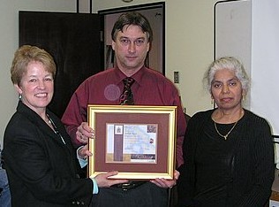
Wendy Watson-Wright-Denis Pigeon-Savi
Denis receives long service award
T.W.R. Pike
• 1860 - As a Master, survey of Bay of Fundy (chart BA 353)
Pillet (French Navy)
• surveyed Newfoundland in 19th Century
•Pillot Bank (chart 4667) possibly named after him
A. Pilon
1970 - Student Assistant - Lower Ottawa River, Que - 4 May to 4 Sept. (from Algonquin College)
J.M. Renaud Pilote
In 1967, Rene Pilote was part of the contingent of hydrographers that attended the International Hydrographic Conference in Monaco on board CSS Baffin.
In 1978, Renaud Pilote, Chief of Tides, Currents and Water Levels Section at CHS Headquarters carried out a reconnaissance of the Niger River investigating the horizontal and vertical control along the river with the purpose of reporting to CIDA on the feasibility of hydrographic charting of the river with the boundaries of Mali.
Source: Lighthouse, Nov. 1978, p. 26.
• 1962 - Officer in Charge? of BAFFIN, Smith Sound & Baffin Bay
• April 1963 (CHS org chart)- Field Officer, Bedford Institute (Technical Officer 4)
1964 - Hydrographer in Charge - CSS Maxwell - NS, NB, Que
• 1965/66- Instructor -Training-Hydro I
Class photo:
1966 - Hydrographer in Charge - CSS Maxwell - NS, Nfld, NB, Que
1967 - Hydrographer in Charge - CSS Maxwell - NS, Nfld, NB, Que
1970 - Hydrographer in Charge - Shore Party # 3 - Pubnico - Yarmouth, NS (13 April - 30 Oct)
1971 - Hydrographer in Charge - CCGS John A Macdonald - Eastern Arctic surveys
J.A. Pinard
• 1960 - classification in 1960: Tech Off 3
Yves Pinard
• Dec. 1935 - appointed to chart construction, as a student assistant.
• 1939-40 - listed as a Map Draftsman (since April 1939)
• 1947 - listed as on staff of chart drafting section
• 1962 - in Chart Compilation
Alexandre J. Pinet, C.E.
Alexandre Pinete (1901 census), born 2 August 1867 in Quebec (1901 census)
• 1904 - came from Railways & Canals upon amalgamation.
• 1904-06 - Lake St. Louis survey.
• 1907-10 - Officer in Charge of Lake of Two Mountains survey, later returned to Ottawa.
• 1911-14 - Lower St. Lawrence survey.
• 1915 - transferred to Drafting Office
• 1915-31 - on staff of Drafting Office.
• Feb. 1931 - died, Senior Map Draftsman 1913-31.
A. (Fred) Pittman
• 1960 - classification in 1960: Tech Off 4
• April 1963 (CHS org chart)- Head Chart Editing & Revised Editions (Technical Officer 5).
• 1905-06 - St. Lawrence River survey.
Plaxton
• 1921 - Dept. of Justice representative on Lake Melville survey
Capt. W.C. Playter
• born 14 August 1868 in Ontario (1901 census)
• 1915-16 - Sailing Master, LA CANADIENNE, Lake Superior survey
• Is Playter Islands (Lake Superior) named after him?
G. Ploughman
1969 - Summer student - CSS Maxwell - NS, Nfld, NB (28 July - 29 Aug) to EOIT
• 1951 - St. Lewis Sound (Lab.) survey (FS 2274)
E.J. Polinsky
• 1961 (CHS org chart)- Pacific Region, Storeman (Storeman 1)
G.E.(or C.?) Polson
• April 1963 (CHS org chart)- Electronic Technician, Bedford Institute (Technician 3)
1964 - Electronic Technician - CSS Baffin - Bay of Fundy survey
1966 - Electronic Technician - CSS Baffin - Tail of the Bank ( 16 May to 10 Nov)
H. Pope
• 1907- Lake Superior survey.
Hon. J.C. Pope
• 1877-80 – Minister of Marine and Fisheries
• 1966/67-Training-Hydro I (Class Photo)
1967 - Hydrographer (AT 2) - CSS Wm J Stewart - BC Coast, various locations
1968 - Hydrographer - Marabell - Various BC locations (24 June to 26 July)
1970 - Hydrographer (ESS 3) - Wm J Stewart - BC, Strait of Georgia (10 May - 15 May)
A. Porter
• 1950 - Second Officer, KAPUSKASING, Labrador Coast
Portlock
• 1776 – sailed with Cook on his third
• 1794 – provided sketch surveys to George Vancouver
• Portlock Point, Prevost Island (Haro Strait) named after him
D.J. Pottier
1970 - Casual Hydrographic Employee - Shore party # 3 - Pubnico - Yarmouth N.S. (10 Sept - 30 Oct)
Capt. Potts
• 1943 - of Hughes Owens - had to fly to Goose Bay for sounder repairs.
Mike Powell
2007 - Retired from active service, Central Region - (from 2007 Lighthouse)
W.H. Powell
• 1910 - Dixon Entrance survey
• 1910 - resigned at end of season
Brian Power
BRIAN POWER - EMPLOYEE WORK HISTORY
BIRTH DATE: 03-Aug-47
MARITAL STATUS: Married
JOINED: 07-Feb-74
EDUCATION: Grade 13
Algonquin College, Civil - 3 years
Hydrography I - 174/75 1st phase
Hydrography II - 1977
Math 1A6 McMaster Unversity - 1980/81
BRIAN POWER - EMPLOYEE WORK HISTORY
WORK YEAR WORK ASSIGNMENT HIC, MANAGER/SUPERVISOR
1970 Student Assistant Rideau River B. Golding
1971 Student Assistant- St. Lawrence R.R. Courtnage / F. DeGrasse
Ottawa River A. Rogers
1972 Student Assistant Arctic G. Wade
Arctic PCSP
1973 Student Assistant Arctic T. Mortomer
Revisory Survey J. Statham
1974 Lower St. Lawrence Ed Thompson
Arctic Surveys Jack Wilson
1975 Revisory Survey J. Statham
Povungnituk Bay Survey Vern Crowley
1976 Lake Superior - BAYFIELD F. DeGrasse, P. Richards
1977 Lake Erie Mike Casey
1978 Baker Lake Bruce Wright
1979 Great Lakes Coastal Jack Wilson
1980 Georgian Bay Harbours Arnie Welmers
1981 Rotation - Aerial Hydrography Jack Wilson
Ground Truthing May & June
1982 North Channel Survey Ken Hipkin
1983 St. Lawrence River Survey Bruce Wright
1984 St. Lawrence River Survey John Medendorp
1985 P.C.S.P. Ken Hipkin
Rotation - Local Surveys Ken Hipkin
1986 North Channel Survey John Medendorp
1987 HIC, Revisory Survey Bruce Wright
1988 HIC, Revisory Survey Bruce Wright
1989 Rotational year George Macdonald
1990 North Channel Survey Arnie Welmers
1991 Lake Ontario Survey Jack Wilson
1992 Churchill Survey Ed Thompson
1993 ENC Brent Beale
1994 ENC Brent Beale
1995 ENC Brent Beale
1996 ENC Sean Hinds
1997 ENC Sean Hinds
1998 ENC, Supervisor Data Transform. Brent Beale
Apr '99 - Mar '00 ENC, Supervisor Data Transform. Brent Beale
2001 ENC, Supervisor Data Transform. Brent Beale
2002 ENC, Supervisor Data Transform. Brent Beale
2003 ENC, Supervisor Data Transform. Brent Beale
2004 ENC, Supervisor Data Transform. Brent Beale
2007 - Retired from active service, Central Region - (from 2007 Lighthouse)
• 1904 - Minister of Marine and Fisheries
Carole Prest
• Started working for CHS at age 17
1965 Joined CHS
1967/68 - working level draftsman - Ottawa
•2000-Reprographics in Ottawa
•Regional Quality Coordinator for ISO Certification and Maintenance
•October 2005-married to Robert (Bob) Farmer-a long time CHS employee
Admiral James Charles Prevost, R.N.
Born 1810 and died in London 1891. Entered the Navy in 1823. Promoted Lieutenant 1835, Commander 1845. As a Commander, he was on the Pacific Station in 1850, in the PORTLAND, the flagship of Rear Admiral Sir Fairfax Moresby, whose daughter he married. In December of 1852, he transferred at Valparaiso, to command of the VIRAGO, where he remained till 1854. He was promoted Captain that year. In 1856, hew as appointed to command of the SATELLITE and was appointed first British Commissioner for the settlement of the San Juan boundary question between British Columbia and the United States. On his return to England, he was an important witness before the Emperor William of Germany, the arbitrator in the boundary dispute. Rear Admiral 1869; Vice Admiral 1876; Admiral 1880.
• 1854 – surveyed part of the Inside Passage, San Juan & Gulf Islands, BC
• Prevost Island, (Haro Strait) named after him
Charles Alexander Price
• born 17 June 1888 in Ontario (1901 census)
• of Brockville
• 6 November 1912 - appointed to Automatic Gauges Section, CHS
• 1913 - water level studies, St. Lawrence River.
• May 1913-26 - Officer in Charge, Automated Gauges Section
• 1923 - installed gauges in Hamilton Inlet
• 1924 - water level transfer Lake Memphremagog.
• 1928-39 - Officer in Charge of Precise Water Levels division.
• 1934 - named Joint Secretary of the Interdepartmental, Montreal & Ship Channel Water levels Board.
• 1940 - named Chief, Precise Water Levels
• 1940-47 - in charge of Precise Water Levels
1967 - Assistant Hydrographer - CSS Baffin - Grand Bank of Nfld (23 June - 7 Aug)
• 1967/68-Training-Hydro I
Photos: Hydro I 1967/68
1969 - Hydrographer - CSS Maxwell - Nova Scotia - Resigned 29 June (to University of Cardiff)
J.S. (Jim) Pritchard
• June 1947 - appointed as an assistant in records and accounts at Headquarters.
• 1961 - Headquarters Staff, Principle Clerk (Principle Clerk).
J.W.F. Pritchard
• 1966 (Field assignment) - Current
Lloyd C. Prittie
• 1913-14 - Hudson Bay survey, ACADIA
• 1915-16 - Halifax Approaches survey
• 1917 - Lower St. Lawrence River survey.
• early in 1918 - commissioned in Royal Naval Reserve, went overseas.
• 1919 - returned from military service.
• 1919-20 - Eastern shore, Nova Scotia survey.
• late 1920 or early 1921 - resigned.
W.J. "Bill" Probert
• 1955 - Assistant Hydrographer - Shoreparty - North Rustico, P.E.I.
• April 1963 (CHS org chart)- Field Officer, Bedford Institute (Technical Officer 4)
1964 - Hydrographer - CSS Baffin - Bay of Fundy survey
1965 - Hydrographer - CSS Kapuskasing - Chaleur Bay (NB and Que)
1966 (Field assignment) - CSS Kapuskasing - Nova Scotia, Gulf of St Lawrence
• 1792 – took over command of CHATHAM from Broughton
• 1793 – surveyed BC coast from Burke Channel, Observatory Inlet, Portland Canal & Pearse Canal
• 1794 – Surveys of Cook Inlet to Baranoff Island & Point Conclusion
• Puget Sound named after him
Dave Pugh
Dave Pugh graduated from Humber College of Applied Arts and Technology (survey technologist program) in 1973. He joined the CHS that same year, and has worked in the Great Lakes area, Hudson Bay and the Arctic Archipelago. He was the hydrographer in charge of Arctic surveys, and was chairman of the national training committee for CHS. He has a Honours Bachelor of Science degree (Earth Sciences) from the University of Waterloo and holds a Canada Lands Surveyor commission.
Source: CISM Journal ACSGC, Autumn 1990, p. 337.
Lighthouse, Spring 1990, p. 3.
• 1996 – 6-month secondment to the Policy Coordination Branch at DFO headquarters
-December 2007-Retired
Hans Walter Pulkkinen
1910-2001
Hydrographer with the Canadian Hydrographic Service, participated in the Polar Continental Shelf Project. He spent many years exploring and surveying the Russian and Canadian Arctic. During his career with the CHS he spent many years on ship based surveys, primarily in Eastern Canada and the Arctic. He loved the Arctic and was justifiably proud of his contribution to northern charting and exploration. During the last few years of his career, he was assigned full time to the office of the Polar Continental Shelf Project where his work was devoted exclusively to Arctic activities.
He died Sunday January 28, 2001, aged 90 years. Husband of the late Glafira Pantina. Loving father of Elvira Pulkkinen of Moscow, Victoria Pulkkinen Chiarelli of Seattle, John Alexander Pulkkinen of Los Angeles and Walter Peter Pulkkinen of Ottawa. Predeceased by daughter Sonja and son Robert.
Source: Lighthouse, Spring 2001, Ed. 59.
Ottawa Citizen, January 30, 2001
• a Finnish surveyor who loved working in the North. [Mapping a Northern Land, p. 220]
• 1960 - classification in 1960: Tech Off 4
• April 1963 (CHS org chart)- Central Region, Field Officer (Technical Officer 4)
1964 - Hydrographer - CSS Acadia - PEI, NS, Nfld - (from Ottawa)
1965 - Hydrographer - CCGS John A. MacDonald - Eastern Arctic Survey (senior Hydrographer till October)
1966 - Staff assignment, Central Region - On rotation from field work
Commander H.E. Purey-Cust, R.N.
• 1897-98 - Officer in Charge HMS RAMBLER, survey of Strait of Belle Isle (chart BA 282, 779)
• 1898 - OIC (HMS Rambler) of Strait of Belle harbour surveys (chart 4668)
G.E. Pyfinch
• April 1963 (CHS org chart)- Drafting and Reproduction, Unit 2, Group E (as Draftsman 1)