

H
He... Hi... Ho... Hu...
Ron H. Haas
• 1960 - classification in 1960: Map Compiler and Computer 1
• April 1963 (CHS org chart)- Compilation Services and Training ( Map Compiler and Computer 2)
1967 - transferred to Navigation Aids section
-1977-Training-Carto I (Class Photo)
1966 - Assistant Hydrographer - CSS Maxwell - Atlantic Provinces and Quebec (20 May to 13 Oct)
• 1966/67-Training-Hydro I (Class Photo)
1970 - Hydrographer - Saint John River survey NB (4 May to 30 Oct)
H.B. Hachey
• 1963 - Secretary of the Canadian Committee on Oceanography
Denis Hains
Denis Hains graduated from the University of Laval, Quebec City in 1983 with a degree in Geodetic Survey Engineering, and began employment with CHS. He was stationed with the Laurentian Region office at Point au Pere, Quebec, and eventually became Regional Director of that office. In 1997, he won a competition for the Director’s position of Geodetic Survey Division, Geomatics Canada, NRCan, and joind the Division in that capacity April 1, 1997.
Source: 1998 Canadian Hydrographic Conference Proceedings, p. 5.
• transferred to Auditing Division, NRCan
• Acting Dominion Hydrographer Oct. 2002- April 2004.
Born 6 Oct 1942
1965 - Hydrographic Assistant (from 5 July) - Trent-Severn Waterway survey, Ontario
• 1965/66-Training-Hydro I (CHS Class Photo)
1966 - Hydrographer - Trent-Severn Waterway Survey, Ont
1967 - Hydrographer - Ottawa River, Chats dam to Bryson dam
• 1968/69-Training-Hydro I - Instructor
From obituary in Evening Telegram:
Hall, Francis Willard, P..Eng., N.L.S. - Passed away peacefully after a lengthy illness at Masonic Park on June 21, 2008. He was a retired survey engineering instructor from the College of the North Atlantic, former President of the Association of Newfoundland Land Surveyors and registered Professional Engineer in both Newfoundland and Ontario. Frank was a respected and accomplished Teacher and Engineer. Frank's passion, sense of humour and love for Newfoundland will be missed by family and friends alike.
James Hall
• 1942 - appointed as a temporary clerk in the Victoria office.
• 1942 - had to be laid off since he was older than 18.
Rolly C. Hamilton
• 1947 - hired as Student Assistant in chart construction
• 1960 - classification in 1960: Superv Draftsman 2 •April 1963 (CHS org chart)- Supervisor, Drafting and Reproduction, Unit 2, Group D (Supervising Draftsman Grade 2)
D.W. Hamilton-Gordon
• 1896 - assistant on survey of Lark Harbour (Bay of Islands, Nfld) (Chart BA 1209)
Obed Hamm
• of Mahone Bay
• 1927 - built CARTIER starboard launch.
Commander G.J. Hammer, R.N.
• 1877 - Officer in Charge HMS DARING, surveyed CPR terminus Skeena River.
H.L. Hammersley
• 1947 - Queen Charlotte & Smith Sounds surveys
Nav. Sub-Lt. G.L. Hammond
• 1866-69 – surveyed Lama Passage & Seaforth Channel, under Pender (chart BA2449)
Commander Hancock, R.N.
• 1852-57 As a Lt., surveyed Great Bras d’Or, under Bayfield (chart BA2687)
• 1859 - in charge of sub-party (under Orlebar), St. Lawrence River
• 1860-63 – surveyed Bay Bulls to Placentia, under Orlebar (chart BA2915)
• 1862-71 – surveyed C Bonavista to Bay Bulls, Nfld., under Orlebar (chart BA296)
Major C.F. Hannington, C.E.
• July 1915 - appointed to Automated Gauges Section.
• 1915-16 - in Automated Gauges Section
• 1917 - granted leave for military service overseas.
• late 1918 - returned from military service to Automated Gauges section..
• 1922-24 - in Automated Gauges section.
• Fall 1924 - resigned.
John T. Hanrahan
• 1947 - hired as Student Assistant in chart construction
• 1960 - classification in 1960: Superv Draftsman 2 April 1963 (CHS org chart) - Supervisor, Chart Drafting and Reproduction, Unit 1 A, (Supervising Draftsman 2)
2007 - Died 19 April at age 75. (Ottawa citizen)
E. Hansen
• 1968 - Student Assistant - Georgian Bay survey, Ont (6 May to 11 Oct)
1969 - Hydrographic Assistant - Ottawa River survey (5 May - 12 Sept) = Resigned 12 Sept
R.B. Hanson
• 1960 - classification in 1960: Draftsman 3
• April 1963 (CHS org chart)- Chart Drafting and Reproduction, Unit 1 A, (Draftsman 3)
Ralph E. Hanson D.L.S.
- 1977
On December 30th, 1965 Ralph Ellis Hanson of Falmouth, N.S. retired from the Canadian Hydrographic Service after some 30 years of topographic and hydrographic surveying.
Mr. Hanson's surveying career began with a Topographic Survey Party of the Department of the Interior in Nova Scotia back in 1924, and following his graduation in Mining Engineering from the Nova Scotia Technical College in 1928 he came to Ottawa where he has since resided. He left the Interior Department in may 1929 to join the Canadian Hydrographic Service, at that time in the Department of Marine. He was commissioned a Dominion Land Surveyor in 1931, and until the year 1956 was actively engaged in charting the coastal waters of the Maritime Provinces, including Newfoundland; the Gulf and River St. Lawrence; Lakes Superior and Nipigon; Goose Bay in Labrador; Coral Harbour and Baker Lake in Hudson Bay; Great Slave Lake; and areas of the MacKenzie River between Great Slave Lake and Great Bear Lake.
In 1947 he added to his Great Slave Lake Survey the motor-launch Rae; and in 1949 was transferred to the Atlantic Coast Survey as Officer-in-Charge of the survey steamer Kapuskasing. His last active field season was in 1956 as Officer-in-Charge of the survey steamer Fort Frances. Since 1957 he has been assigned to headquarters in Ottawa.
Over the past forty years Mr. Hanson has seen many changes in techniques pertaining to field and office work, some of which he played a part. In 1927 he was with the first Topographic survey party to adopt air photography for field mapping in Nova Scotia, and his chart of St. Anne's Harbour, Cape Breton, drawn in 1937, was from the first blue-line printing used for fair copies in the Hydrographic Service. In 1955 when in charge of the Kapuskasing he carried out the first Decca Surveys in the Gulf of St. Lawrence, and finally in 1957 he was attached to a party for a short duration that made the first Tellurometer Survey in the Service along the St. Lawrence Seaway.
Source: Soundings, August 1966.
• 1929-34 - Magdalen Islands & Lake Superior (1930 only) survey.
• 1935 - Cape Breton - Magdalen Is. survey
• 1936-38 - Cape Breton survey.
• 1937 - surveyed St. Anns Harbour, N.S. (chart 4368)
• 1938 - Officer in Charge of Lake Nipigon survey (over the ice)
• 1938 - Northumberland Strait survey
• 1939 - Officer in Charge of Lake Nipigon survey.
• 1940-41 - St. Lawrence River survey.
• 1941 - Newfoundland surveys
• 1942 - Lake St. Peter, Goose Bay Labrador, Hudson Bay surveys (N.B. McLEAN)
• 1943 - Goose Bay & Hudson Strait surveys
• 1944 - Yellowknife survey
• 1945-46 - Officer in Charge of MacKenzie River survey
• 1947 - Officer in Charge of Great Slave Lake & Great Bear Lake survey
• 1948-49 - Hudson Bay surveys (1949 CSL Grebe)
• 1949-50 - Officer in Charge of KAPUSKASING, Atlantic Coast surveys
• 1950 - surveyed harbours in Hare Bay, Nfld. (chart 4516, 4519)
• 1952 - surveyed Pomquet & Tracadie Harbours, N.S. (chart 4447)
• 1952 - surveyed Port Hood, Mabour Harbour & Havre Boucher, N.S. (chart 4448)
• 1952-55 - Officer in Charge of KAPUSKASING, Atlantic Coast surveys
• 1953 - surveyed Chéticamp to Cape Mabou (chart 4449, 4463)
1955 - Gulf of St Lawrence - first use of two range decca
• 1956 - Officer in Charge of FORT FRANCES, Newfoundland surveys.
• 1961 - Headquarters Staff, Engineer (Engineer 5)
• April 1963 (CHS org chart)- Special Projects (Engineer 5)
Alec. Hantzis
• 1964 – joined CHS, Compilation Section
1967/68 - working level compiler - Ottawa
Miss E. Hardy
• 1946 - appointed as stenographer at Headquarters.
• 1961 - Headquarters Staff, Stenographer (Stenographer3)
Lieut. E.C. Hardy, R.N.
• 1900-01 - on HMS EGERIA, Johnstone Strait (chart BA 3260, 3333, BA3387)
G.M. Gathorne-Hardy
• ? – sketched coastline at Hebron, Labrador (chart BA1221)
G.Y. (Gord) Hare
• 1961 - East Coast Staff, Clerk (Clerk 4).
1964 - Ship's clerk - CSS Acadia - PEI, NS, NL
Robert Hare
Rob has been a field hydrographer with the Pacific Region of CHS since 1982. He holds a Diploma in Survey Technology (1982) and a B.Sc. in Surveying Engineering from the University of Calgary (1991). He has been involved in special projects such as GPS applications in hydrography, multibeam echo-sounders, and in a project designed to find ways to assess the quality of digital hydrographic data.
Sources: Geomatica, Summer 1993, p. 128.
Lighthouse, Fall 1993, p. 20.
Geomatica, Spring 1994, p. 130.
1998 Canadian Hydrographic Conference Proceedings, p. 5.
Lieut. J.S. Harris, R.N.
• 1900-01 - on HMS EGERIA, Johnstone Strait (chart BA 3260, 3333, BA3387)
Lieut. John Harris, R.N.
• 1839 - last British Admiralty survey in Great Lakes, in Lake Erie
John Harris, R.A. or R.N.
• 1839 - chartmaker for map of Long Point
K. Harris
1967 - Sooke Harb. and Approaches (10 Sept - 20 Oct) 1967 - Sooke Harb. and Approaches (10 Sept - 20 Oct)
W.J. Harris
1966 - Field assignment, Pacific Region - Parry
B. Hartling
• 1966 - Electronic Technician - CSS Baffin - Tail of the Bank (27 Aug to 10 Nov)
Sub-Lieut. J.R. Harvey
• 1906 – surveyed Port Simpson, B.C., under Learmonth (chart BA3678)
Dr. Eugene E. Haskell
• Dean of Civil Engineering, Cornell University
• patent holder for Haskell type automatic water gauge.
• 1906 - American Consultant Hydraulic Engineer, Int'l Waterways Comm.
• 1909 - Commissioner on the International Waterways Commission.
• 1913-14 - consultant on St. Lawrence River water levels
Staff Commander F. Haslewood, R.N.
• 1872-85 - survey of S Nfld. - under Maxwell (chart BA 2141)
• 1877-81 – as a Nav. Lt., survey C. St. John-Toulinguet - under Maxwell (chart BA 285)
• 1882 –survey of Femme Bay (Fortune Bay), Harbour Breton (chart BA292, 4609)
• 1882-85 – surveyed Burin Hbr to Devil Bay (chart BA893)
• 1883 - survey of Gaultois & Picaire Harbours (chart BA292, 4609)
• 1884-5 - survey of Bonne Bay & Great Jervis Harbour (chart BA292, 4609)
• Haslewood Bank (45° 34' 58"N, 80° 33' 34"W) possibly named after him.
Capt. Haufman
• 1929 Captain of Dredge #16, lower end of Orleans Island, submitted slack water info.
E.R. Haughton
• 1965 - Summer student - CSS Wm J Stewart - 11 May - 11 Sept - (from U.N.B.)
Miss Hawkins
• 1942 - appointed as Student Draftsman in the Victoria Office.
G.E. Hawkins
• 1947 - Place Names, Pacific Office
Sydney C. Hayden
• 1903 - joined Tidal and Current Surveys.
• 1905 - visited British Columbia with Dr. Dawson.
• 1909 - installed tide gauges north of Vancouver Island.
• 1913 - observed slack water at Ripple Rock and elsewhere
• 1919-28 - Senior Tidal and Current Surveyor, Pacific Coast
• 1924 - transferred to Vancouver.
• 1933-34 - examined currents in Vancouver harbour
• June 1940 - retired from Vancouver Office.
B.F. Hebb
• 1964 - Student Assistant (26 May - 4 Sept) from NS Land Survey School - CSS Maxwell - NS,NB, Que
H (orR) Heidebrecht
• 1960 - Officer in Charge of THETA, Bay of Fundy & Lancaster Sound.
P. Heinrichs
• 1966 - taken on strength - Compilation unit - Ottawa
1967/68 - Working level compiler - Ottawa
• of Chester, N.S.
• 1942 - built CHL ANDERSON
• 1944 - converted launch ESCAPADE into CHL DAWSON
K. Hemeon
1969 - CSS Maxwell - Atlantic Provinces (28 July - 23 Aug)
Milton A. "Junior" Hemphill
Milt first saw the light of day in Pictou, Nova Scotia in 1929. He progressed through the local school system and joined the CHS as a seaman in 1950 on the CSS Acadia. He transferred to the hydrographic side in 1952 and worked his way up to the HIC level. Milt is a legend within his own right in the CHS. The only thing predictable about Milt was that he would start at least two arguments each day so he would get the opportunity to argue both sides. The typical Milt was in evidence a few years back when at a workshop in Victoria he gave his opinions on development and automation.
Source: Lighthouse, April 1984, p. 48 and grandson, Peter.
1964 - Hydrographer - CSS Baffin - Bay of Fundy survey (8 Sept - 30 Oct)
1965 - Hydrographer - CSS Kapuskasing - Chaleur Bay (NB and Que)
1966 - Hydrographer in Charge - DOT Ships - Eastern Arctic Surveys
1968 - Hydrographer in Charge, d'IBERVILLE, Eastern Arctic
1969 - Hydrographer in Charge - CSS Maxwell - Atlantic Provinces Revisory, Mortier Bay (Nfld), Port aux Basque (Nfld), Avon River (NS)
1970 - Hydrographer in Charge - CSS Maxwell - Chart Revisory and Navigational Ranges Surveys - Gulf of St. Lawrence
1966 - Hydrographic Assistant - CSS Acadia - Magdalen Islands (Que) and Newfoundland
1966/67-Training-Hydro I (Class Photo)
1967 - Hydrographer - CSS Maxwell - NS, Nfld, NB, Que
1969 - Hydrographer - Lower St Lawrence Survey (water jet boat, parallel sdg) 5 May to 21 Oct
1970 - Hydrographer - Shore party No.2 -Ship Harbour to Liscomb Harb, NS - 4 May to 30 Oct
W.B. (Bill) Henry
1960 - classification in 1960: Tech Off 4
April 1963 (CHS org chart)- Central Region, Field Officer (Technical Officer 4)
P. Heppel
1969 - CSS Maxwell - Nova Scotia (9 June - 18 July)
F.V. Hermiston
1964 - Hydrographer - Wm J Stewart - BC
1965 - Hydrographer - CSS Wm J Stewart - Juan de Fuca Str, Hecate Str, Ste of Georgia
1966 - Hydrographer - Wm J Stewart - Strait of Georgia ( 18 Apr - 8 May)
1966 - Hydrographer - CSS Richardson - Western Arctic (9 May to 15 Sept)
1967 - Hydrographer - CSS Marabell - BC Coast - various locations (17 April to 15 Aug and 30 Aug to 12 Oct)
Terese Herron
In 1984, Terese graduated from the University of Waterloo with a Bachelor of Environmental Studies degree in Geography. In 1995, she is employed by the Central and Arctic Region of CHS in the Field Surveys Division, having been hired in 1985.
Source, Lighthouse, Fall 1995, p. 3.
A.C. Hewitson
1946 - Student Assistant on St. Lawrence River survey
1947 - St. Lawrence River (below Montreal) survey
D.B. Hexemer
1967 - Student Assistant - CSS Maxwell - Atlantic Provinces (May 10 to Aug 27) from Ryerson College Tech
1965/66-Training-Hydro I (CHS Class Photo)
1966 - Field assignment, Central Region - Rainy Lake Shoreparty
1967 - Hydrographic assistant - CSS Marabell - BC Coast - various locations (12 June to 6 Oct)
1967/68-Training-Hydro I
Photos: Hydro I 1967/68
1968 - Hydrographer (Tech 1) - Wm J Stewart - BC Coast - numerous locations
1969 - Hydrographer - CSL Revisor - southern BC - revisory surveys
S. Hill
1964 - Summer Student (Hydrographic Assistant) Wm J Stewart - BC
P.A. Hiltz
• 1965 - Summer Student from Lawrencetown (17 May - 27 Aug) - CSS Kapuskasing - Chaleur Bay (NB and Que)
C. Himmelman
1967 - taken on strength - compilation unit - Ottawa
1968 - working level compiler - Ottawa
Bill Hinds
Bill Hinds graduated from BCIT in 1972, has worked for the Canadian Hydrographic Service for 25 years, providing electronic support for field and office activities. He has been the Head of Institute [of Ocean Sciences (Pat Bay)] Electronics since 1987.
Source: Lighthouse, No. 56, Fall 1997, p. 33.
Sean Hinds
Sean Hinds graduated from the Hydrographic Survey program at Humber College of Applied Arts and Technology. He has worked with CHS since 1981. He was commissioned as a CLS in 1986. After completing 12 years of field hydrography he moved to paper chart production. He was the project leader of the 1996/97 Next Generation Printing project. He was the A/Manager Electronic Navigation Chart Division at Central and Arctic Region, CHS in 1998.
Source: 1998 Canadian Hydrographic Conference Proceedings, p. 6.
• head of ISO implementation
• fall 2002, won position as head of ISO procedures for CHS nationally
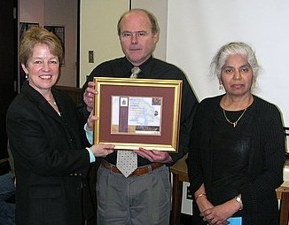
Wendy Watson-Wright-Sean Hinds-Savi
In Loving Memory
SEAN B. HINDS
MAY 10, 1955 – FEBRUARY 4, 2021
With heavy hearts, the Hinds Family sadly announces the passing of a loving father, brother, brother-in-law, uncle, and friend. Sean Bernard Hinds, loving brother and devoted father passed away at his home on February 4, 2021, at the age of 65. Sean fought a courageous battle with cancer, diagnosed during COVID-19, which made his fight that much harder on both him and his children.
Sean was preceded in death by his father, Russell Hinds, and his mother, Mary Hinds (née Vincer). He will be sadly missed by his children Matthew, Christopher, and Kaitlin and their mother Lynn (Smellie). Loving brother to Catharine (Howard), Meegan (Marc) and Sarah (Tony). Dear uncle to Zoé, Jordan, Sasha, and Ariel.
Sean was born May 10, 1955, in Barrie, Ontario. He spent his childhood in Barrie, London, and then Thornhill. He started his own family in Georgetown, then moved to Manotick, and later retired in Nepean. Sean had an extraordinary career. He received his Honours Diploma in Hydrographic Survey Technology from Humber College in 1981. He was commissioned as a Canada Land Surveyor and was a Field Hydrographic Surveyor. He helped create the nautical charts and the digital infrastructure to allow for the safe and efficient navigation at sea and in the Great Lakes. Early in
his career Sean was posted to expeditions to chart the Arctic Ocean where his team lived in tents in extreme weather conditions. In the Arctic, Sean even survived a helicopter crash and lived to tell the story of the rescue amidst a fierce storm. Eventually Sean became a Senior Advisor in the Department of Fisheries and Oceans Canada (DFO) travelling to many countries to share his knowledge and work. In 2012, Sean was honoured for his hard work and service to the Government of Canada with a special Governor General’s Award, the Queen Elizabeth’s II Diamond Jubilee Medal. This recognition was a source of pride for both his family and his father who travelled to Ottawa for the ceremony. At the end of 2015, Sean retired from DFO after 35 years of dedicated service.
While Sean had a uniquely fascinating career and received national recognition for his work, he would say that his best lifetime achievements were Matt, Chris and Kait. Sean’s undying passion was family. He instilled strong family values in his children and taught them to love the outdoors as much as he did. One special place where Sean and Lynn created many family memories was Temagami, where Lynn’s family had their cottage.
Sean encouraged his children to pursue their personal interests as he did. Sean had a passion for sailing, travelling, cooking and reading. He was an accomplished sailor joining Catharine and Howard on many sailing trips in the British Virgin Islands. Sean spent four months when he retired exploring New Zealand, Australia and sailing the South Pacific. He volunteered his time maintaining Canada’s historical boats and attending many historical re-enactments. He was also a gourmet and took great pride in preparing special family dinners complete with fine wines and the odd fine Scotch! He was an avid reader, which he inherited from his father. His children have fond memories of Sean reading
bedtime stories night after night, and introducing them to The Hobbit.
Sean was also generous of heart and well known in his parish for his volunteer work, making food and Christmas baskets for those in need. He was an articulate orator and his three sisters will cherish memories of Sean’s heartfelt toasts to the brides at each of their weddings. He loved to remember special occasions, such as birthdays by sending cards always accompanied with a beautifully crafted personal note and ending with a happy face or a little flower. Sean was a deeply sensitive man who leaves a broken heart with everyone who loved him. [Source: Sean Hinds Obituary]
N.J. Hineson
• 1964 - 1 June - 25 June, attached to CSS Kapuskasing - Chaleur Bay ( from Ottawa)
1966 - Student Assistant - Entrance to Georgian Bay - shore party - 2 May to 3 Sept
1967 - Assistant Hydrographer - Georgian Bay survey, Ont - May 7 to Oct 15
• 1967/68-Training-Hydro I
Photos: Hydro I 1967/68
1968 - Hydrographer - Georgian Bay survey
1968 - Hydrographer - Trent-Severn Survey, Ont. (15 Oct to 22 Oct)
1969 - Hydrographer - CSS Baffin - Gulf of St Lawrence ( 28 May - 25 July)
1969 _ Hydrographer - Rideau Waterway survey, Ont (29 Oct - 22 Nov)
1970 - Senior Assistant - Lake of the Woods survey, Ont ( May 11 - Oct 10)
Dr. Johan Hjort
• Director of Fisheries, Norwegian Government
• 1915 - Officer in Charge of Oceanographic cruise, ACADIA
• April 1963 (CHS org chart)- Drafting and Reproduction, Unit 1, Group B (Student Draftsman)
W.O. Hodgins
• 1940 - appointed Senior Map Draftsman.
• 1946 - Chief, Chart Drafting
• 1960 - classification in 1960: Tech Off 6
• April 1963 (CHS org chart)- Head of Chart Drafting (as Technical Officer 6)
Lieut. O.T. Hodgson, R.N.
• 1907-09 - on HMS EGERIA, survey of Browning Entrance (chart BA 2453)
D.I. Hogan
• 1947 - Great Slave Lake & Great Bear Lake survey
George Holbrook, R.N.
• 1819-20 - As Master, surveying in Newfoundland [Ritchie, The Admiralty Chart, pp. 117-8]
•Holbrook Head (Bonavista Bay) named after him
H.J. Holdsworth
• 1960 - classification in 1960: Tides and Water Level Section, Technician 3
• April 1963 (CHS org chart)- Tides and Water Levels, Instruments (as Technician 3).
K.R. Holman
• 1973 - headed Chart Revision Unit, Pacific Region
T.F. Holmes
• 1944 - temporary hydrographer, Northumberland Strait survey.
Paul Holroyd
Paul N. Holroyd, has been with the Canadian Hydrographic Service since 1982. He graduated from the geography programme at Carleton University in Ottawa, with a specialty in Geographic Information Systems, cartography and computer science. Since joining the CHS he has served in a variety of functions including cartographic research, software development and system support, Manager of Electronic Charting and most recently Manager of Nautical Publications & Distribution. Mr. Holroyd sits on the CHS Products & Services Committee, the CHS Marketing Working Group, the CHS Hydrographic Information Network (HIN) Working Group and, along with colleagues in the Canadian military, represents Canada on the Digital Geographic Working Group Technical Committee (DGIWG TC). He is married to Shelley and they have two young daughters, Amanda and Jessica..
Source: 1998 Canadian Hydrographic Conference Proceedings, p. 6.
International Hydrographic Review, Vol. 1, No. 2, December 2000, p. 29.
• 2002+/- Manager, Nautical Publcations
• 1977-Training-Carto I (Class Photo)
R. Hopkins
1970 - Student Assistant - Lower Ottawa River, Que - 11 May to 28 Aug (from Queen's University)
E. Hopper
1969 - Student Assistant - Lower St Lawrence Survey (4 May to 22 Aug) from Ottawa
1970 - Student Assistant - Lower St Lawrence Survey = 4 May to 4 Sept
Capt. Hoppner, R.N.
• 1825 – surveyed Port Neil, Cockburn Island in the Arctic (chart BA261)
Richard Horrigan
• Began his CHS career as a student in Chart Corrections and Shipping and Distribution. Eventually he was employed as an indeterminant in Chart corrections. In 2002 he began updating raster charts used for POD (Print on demand) printing using MicroStation and Iras/B software.
• 1965/66-Training-Hydro I (CHS Class Photo)
Hose, R.N.
• surveyed in Newfoundland in 19th Century
D.J. Houlahan
• 1947 - hired as Student Assistant in chart construction
Major John Houliston
born 5 August 1869 in Canada (1901 census)
• 1904 - came from Public Works upon amalgamation, St. Lawrence R. survey.
E.B. Howard
• 1964 - Summer student from Lawrencetown,1 June - 8 Aug, attached to CSS Kapuskasing - Chaleur Bay
1964 - 8 August transferred to CSS Baffin - Bay of Fundy survey
1965 - Summer student from Lawrencetown (17 May to 6 Aug) - CSS Kapuskasing - Chaleur Bay (NB and Que)
1967 - Assistant Hydrographer - CSS Baffin - Grand Bank of Nfld (22 May - 6 Oct)
• 1967/68-Training-Hydro I
Photos: Hydro I 1967/68
1968 - Hydrographer - CSS Acadia - Isle Aux Morts, Hamilton Sound, Nfld
William Stanford Huggett
Stan Huggett retired from the Canadian Hydrographic Service on May 30, 1988, ending a career that spanned 35 years. Stan joined the CHS as a junior hydrographer on May 30, 1953. Prior to that, he had served as an officer cadet on merchant ships from 1942 to 1946, and then with various steamship companies as third mate, second mate and chief officer. He received his Masters Foreign Going certificate in August 1952.
During his career, Stan had made many noteworthy accomplishments. In 1958, he was placed in charge of CHS involvement with the blowing up of Ripple rock in Seymour Narrows. In this capacity, he advised on the best time for the blast (on Easter Monday during a strong ebb tide), planned current and wave studies, and carried out the post explosion hydrographic surveys. In 1960, he became involved in discussions with the naval architects regarding a replacement for the CSS Parry. This new vessel is the CSS Parizeau, which was commissioned in 1967. Stan Huggett was its first hydrographer-in-charge and for several years used the vessel extensively for tide and current surveys in the Strait of Georgia. The data collected during this period provided much of the information needed for a numerical model developed by Cr. Pat Crean. This model ultimately led to the very successful Current Atlas of Juan de Fuca Strait and the Strait of Georgia.
Over the years, Stan had a very enjoyable and productive association with the Parizeau, carrying out hydrographic and oceanographic surveys in the western Arctic and on the British Columbia coast, in addition to cruises to Japan and the equatorial Pacific.
From drift pole and mast and boom measurements of currents in narrow passes, to Ekman and CMDR in situ current meters (recording with ball bearings and punch paper tape respectively), to the workhorse Aanderaa current meters, and finally today's surface drifters and vector averaging current meters, Stan has installed and recovered more than anyone else in Canada. He has published 19 volumes of data reports on the British Columbia Coast alone. More than a few oceanographers have benefited from Stan's knowledge and experience over the years.
Stan's most recent projects have been to determine the current patterns in Hecate Strait, Dixon Entrance, and off the west coast of Vancouver Island. During this time, he was also actively involved in the planning and designing of the CSS Wm. J. Stewart replacement, the CSS John P. Tully, which was commissioned in 1985. It is unfortunate that Stan never had an opportunity to conduct a survey with the CSS John P. Tully before he retired.
Source: Lighthouse, Fall 1988, p. 46.
1966 - HIC - CSS Richardson - Western Arctic including Tuktoyaktuk
John Hughes Clarke
John Hughes Clark has degrees in Geology (BA, Oxford) and Oceanography (M.Sc., Southampton; Ph.D., Dalhousie). He has worked in the field of marine swath mapping since 1983, initially in deep water at BIO and James Cook University, Australia, but more recently in shallow water at UNB, where is an associate professor. With a primary interest in seabed sediment transport, he has focused on the limits of the topographic and textural information that can be collected from acoustic swath sonar surveying.
Source: 1998 Canadian Hydrographic Conference Proceedings, p. 6.
P.M. Hughes (Mrs.)
• 1961 - Tides and Water Levels, Clerk (Typist 2).
A.E. Humphrey
• 1907-08 - Assistant Hydrographer - BAYFIELD II - Lake Superior survey.
• end of field season 1908 - resigned.
Philip Humphrey
•1998-Chart corrector in Russell Road office
(Source: Stacey Kirkpatrick)
G. Humphries
1970 - CSS Maxwell - Revisory and Range surveys, Gulf of St Lawrence - 4 May to 10 Sept - terminated employment
Frank P. Hunt
(1921-1999)
Frank Hunt, an Arctic surveyor who helped draw the 60th parallel, the line that separates the four western provinces from the Yukon, Nunavut and the Northwest Territories, has died aged 77.
From 1953 to 1957, Mr. Hunt surveyed the 60th parallel. He preferred the winter since the swamps, muskeg, lakes and rivers were frozen. Surveying teams worked with a tripod with a telescope on top, aimed at a target on another tripod as far away as they could put it. They triangulated their way across the north, sometimes covering 80 kilometres a week, sometimes only a few kilometres in mountainous terrain.
Much of it depended on the line of sight, or how far away the surveyors could place their "target" tripod. This was before the snowmobile or the helicopter. Mr. Hunt traversed the north on snowshoes – his colleagues preferred skis, and teased him about his old fashioned footwear – on dog sleds and in single-engine Otter aircraft that could land on ice and snow with their tires and skis. On surveying trips, the teams would work from a base camp, but in the field they lived in tents. They spent as much as three months in winter and two months in summer mapping the north the hard way, from the ground.
Mr. Hunt was so calm about his work that nothing seemed to bother him. His colleagues say he would calmly level his tripod on shifting ice that would send most people scrambling for shore. This coolness came from a man who couldn’t swim. He was prized as a travelling companion because of his luck and his eye for solid ice.
Francis Patrick Hunt was born in Argentia, Newfoundland, on August 10, 1921, the son of a blacksmith. His father died when he was just 3 years old and his mother, Mary, raised three boys and four girls on her own. At the outbreak of the war, the 18-year old chose to join the Royal Canadian Navy. After the war, Frank worked in the Maritimes for several years before being hired by the federal government, for the Surveying and Mapping Branch of the Topographic Survey of Canada. In 1947, he received his NSLS at the Nova Scotia Land Survey Institute. Mr. Hunt became known for something they couldn’t teach in school: An obsession with accuracy and the ability to work in temperatures of -40° C as if it were a spring day.
After his survey of the 60th parallel, Mr. Hunt was the most experienced Arctic surveyor in the country. He was the first surveyor hired for the Polar Continental Shelf Project (PCSP). Mr. Hunt signed on at the start and stayed with the project for 34 years.
After he retired from the PCSP in 1993, Mr. Hunt led a quite life at his home in Ottawa.
Mr. Hunt received the Centennial Medal in 1967, and the Canada 125 Medal in 1992. His daughter, Patricia, is a geologist with Geological Survey of Canada in Ottawa. He is also survived by his wife, Phyllis.
Source: National Post, March 27, 1999, copied by CHA (Central Branch) Newsletter, Vol. 13, No. 4 July/August 1999.
Geomatica, Vol. 53, No. 4, 1999, p. 474.
Leamond Hunter
Leamond "the demon" first emerged from the coal dust in Springhill, Nova Scotia, in 1925. He served in the RCAF from 1943 to 1945. This was followed by a one-year stint at Mount Allison University and then to the Nova Scotia Land Survey Institute where he graduated with his Nova Scotia Land Surveyors Commission.
He joined CHS in 1948 as a field surveyor. Lea is one of the few in CHS who can truly call himself a "Chartmaker". He became an HIC in 1953 working on the east coast. In 1970, he transferred to the cartographic side of chartmaking.
Lea is a cocky little guy who always gives as good as he takes. This is typified by the time the Executive Assistant to the Dominion Hydrographer, who was twice Lea's size, blasted him for spelling his name wrong and pointed out that it was on his door. Hunter's reply was, "That's nice, but I didn't have the damn door in the field with me."
Source: Lighthouse, April 1984, p. 48.
• 1954 - Officer in Charge of Placentia Bay survey (chart 4617, 4618)
1955 - Officer in Chardge CHL DAWSON, Placentia Bay, Nfld
• 1958 - Officer in Charge - CHL "Dawson" - NFLD
• 1960 - classification in 1960: Tech Off 5
•April 1963 (CHS org chart)- Central Region, Field Officer (Technical Officer 5)
1964 - Hydrographer - Wm J Stewart - BC - April to July
• April 1965 - transferred to Production Analysis Section at Ottawa
R.L.B. Hunter
• spring 1931 - hired as Junior Hydrographer (Grade I).
• 1931 - Hudson Bay survey.
• 1932-34 - North Shore of Gulf of St. Lawrence survey.
• 1935 - Hudson Strait shore party
• winter 1935 - tidal current calculations
• 1936 - North Shore of Gulf of St. Lawrence survey.
• 1937 - Cape Breton Island survey
• early 1938 - resigned.
G.T. Hutchingame
• April 1963 (CHS org chart)- Chart Distribution (Packer and Helper)
Trevor Hutchinson
•March 1990-began in Chart Corrections-Russell Road office
•1999-Assignment in Notice to Mariners-Booth Street Office
(Source: Stacey Kirkpatrick)
G.W. Hyndman
• 26 April, 1897 - added to Mr Stewart's staff for surveys in Lakes Erie and Huron.
• 1898 - resigned from Great Lakes Survey.
Commander Hyndman
• 1860-63 – surveyed Bay Bulls to Placentia, under Orlebar (chart BA2915)
• 1862-71 – surveyed C Bonavista to Bay Bulls, Nfld., under Orlebar (chart BA296)